Historic features · Featured site

From Golden Age to Lost Remains

The Archbold and Rowell estates on Cleftstone Road

On the west side of Cleftstone Road, below Great Hill, two summer estates of Bar Harbor's cottage era stood side by side for more than forty years. Anne Archbold, a Standard Oil heiress, built an Italian villa here in 1903 and 1904. In 1916 Frank Bailey and Christine Baker Rowell of New York bought the lot next door, which they called Barberry Ledge. Both houses burned in the fire of October 1947, and today the land is part of Acadia National Park. In the woods you can still find fountains, staircases, foundations, red roof tiles and boundary stones. This page follows the deeds from Charles T. How's sale in 1902 to the park's purchase in 1989, and the August 2009 field days when our crew mapped what was left.

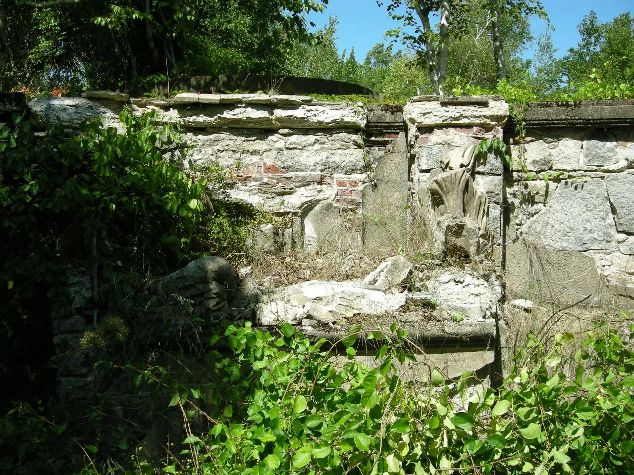
A ruined terrace wall of stucco and decorative concrete in summer woods
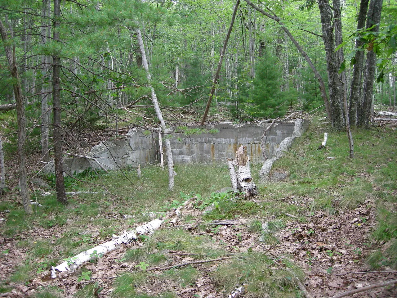
The terrace wall at the large fountain, Anne Archbold's villa, 20 Aug 2009
Before the cottages

Charles T. How's hillside

The 1881 Colby atlas shows no roads at all between Eden Street and the Eagle Lake Road. Over the next ten years real estate developers, chiefly Charles T. How, built a network of roads around the low hills west of the village to create lots for summer cottages: Highbrook, Bloomfield, Woodbury, Devon and Cleftstone roads. By 1896 Cleftstone Road ran south to the Eagle Lake Road, and How still owned most of the slope between the road and Great Hill.

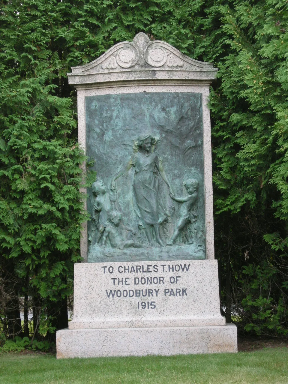
How's deeds carried more than land. Buyers on Cleftstone Road received a right of way over "Acadia Lane" from Eden Street down to the shore of Frenchman Bay, the use of 25 feet of shore at its end, and rights over a semicircular parcel near Acadia Landing that How had first granted in 1889. How died in October 1909. His administrators, Samuel W. Bates and Frank C. Bates, went on selling his land, and in 1915 Bar Harbor put up a bronze memorial "To Charles T. How, the donor of Woodbury Park."

This page draws on the Hancock County deeds and court papers in the Library, the draft Great Hill trail study in the same archive, and the August 2009 field data. Background on Anne Archbold comes from Wikipedia and Glover Park History; the villa's garden is described by The Down East Dilettante.

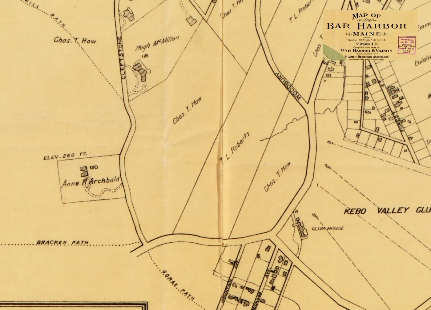
1904 map of Bar Harbor showing Cleftstone Road, the Anne M. Archbold lot at elevation 260 feet, Charles T. How's land and the Bracken Path
The 1904 Summer Residents Association map: lot 120, "Anne M. Archbold," at elevation 260 feet off Cleftstone Road, with Charles T. How's land all around and the Bracken Path and Gorge Path below
Eight stops, 1902 to 2009

The estates in the woods

The numbered pins mark each stop in the story, from the Archbold entrance at the south end of the lots to the summits of Great Hill. Smaller dots are related field points from August 2009: stairs, drains, boundary markers, cairns and finds. The crew's tracks over the estates and Great Hill are drawn over the 1942 USGS map. Click any point for its field note.

Feature or find Boundary mark, road or note Cairn
1

The gate on Cleftstone Road

Lot bought 8 Nov 1902 · 3 acres · enlarged 1906 · 5.87 acres in all

On 8 November 1902 Charles T. How sold "Anne M. Archbold" about three acres on the west side of Cleftstone Road, as surveyed by Edgar I. Lord on 15 October 1902. The deed was recorded a week later in Book 382, page 528, and it carried the Acadia Lane right of way and the 25 feet of shore. Archbold was 28, an artist who had studied in Paris and Florence.

In 1903 she began a house based on a model she had had made in Paris and inspired by villas she had seen in Tuscany. It was designed by the Bar Harbor architect Frederick Lincoln Savage and finished in 1904, with a terraced garden and fountain, twelve stucco arches looking out over the forest, the mountains and the sea, and a spiral stair from the main bedroom to a tower with a view in every direction. A local newspaper called it one of the most unusual houses in Bar Harbor. The 1904 map shows a drive winding up to it from Cleftstone Road.

Found in the field · 20 August 2009

Granite memorial with a bronze relief of a woman leading children, inscribed To Charles T. How the donor of Woodbury Park 1915
"To Charles T. How, the donor of Woodbury Park, 1915," 22 Aug 2009
2

The villa terrace and its fountains

Built 1903–1904 · Janet Scudder, Fred Savage and E. E. Soderholtz

Archbold designed the villa together with the sculptor Janet Scudder and Fred Savage. Its garden centered on a circular lily pool with a dolphin fountain modeled on an 18th-century French original, and all of the decorative concrete was made by Eric Ellis Soderholtz, the West Gouldsboro potter whose garden urns and balustrades decorated many of the great Bar Harbor estates.

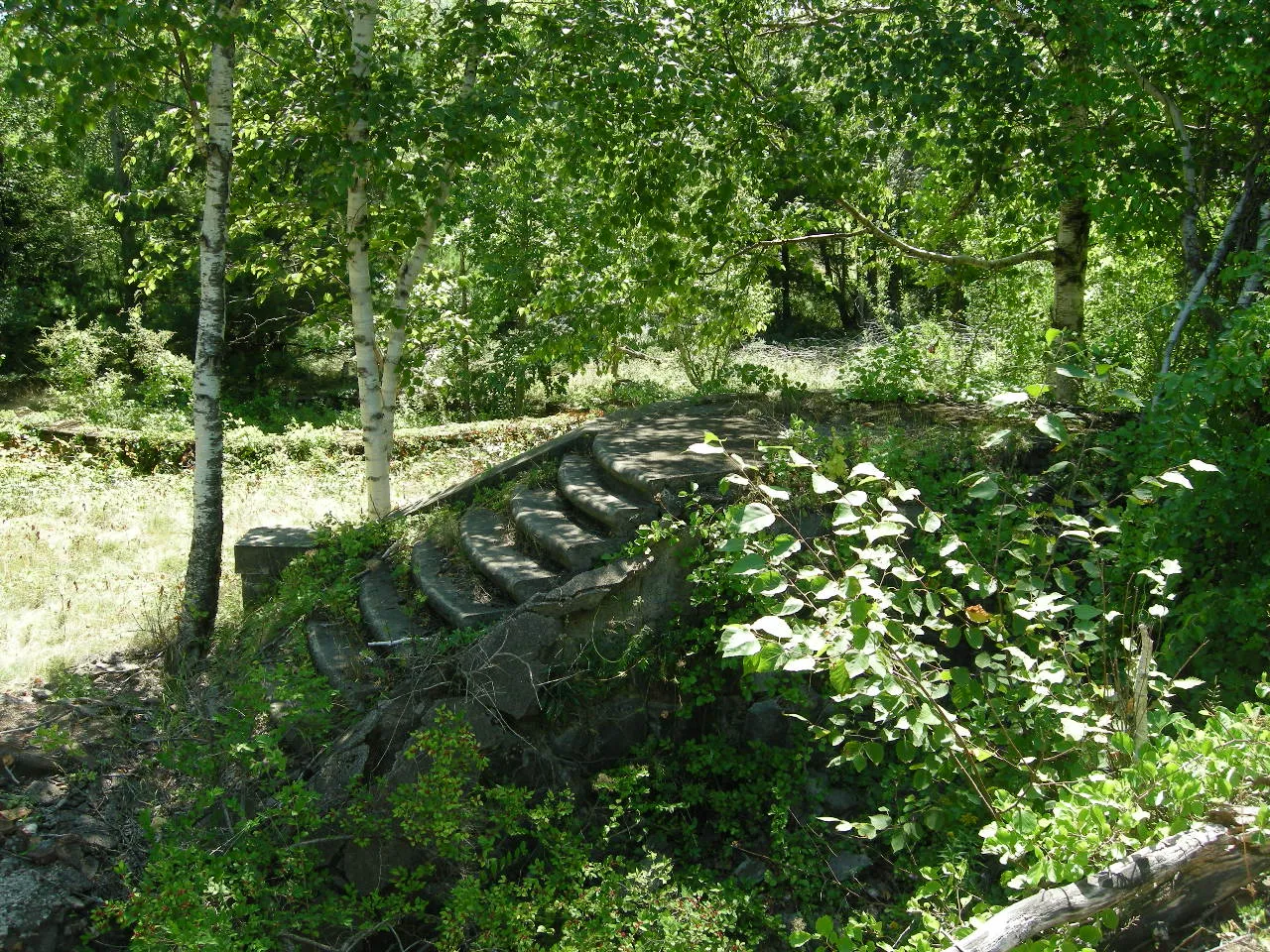
That concrete has outlasted the house. On 20 August 2009 the crew found the large fountain in front of the house, the small circular pool beside it, and a double staircase "up to house," with pieces of the terrace walls still standing in the woods. Behind the house they found a 20-inch drain and, a few days later, a stair, an iron pipe and an old wooden post.

Found in the field · 20 to 31 August 2009

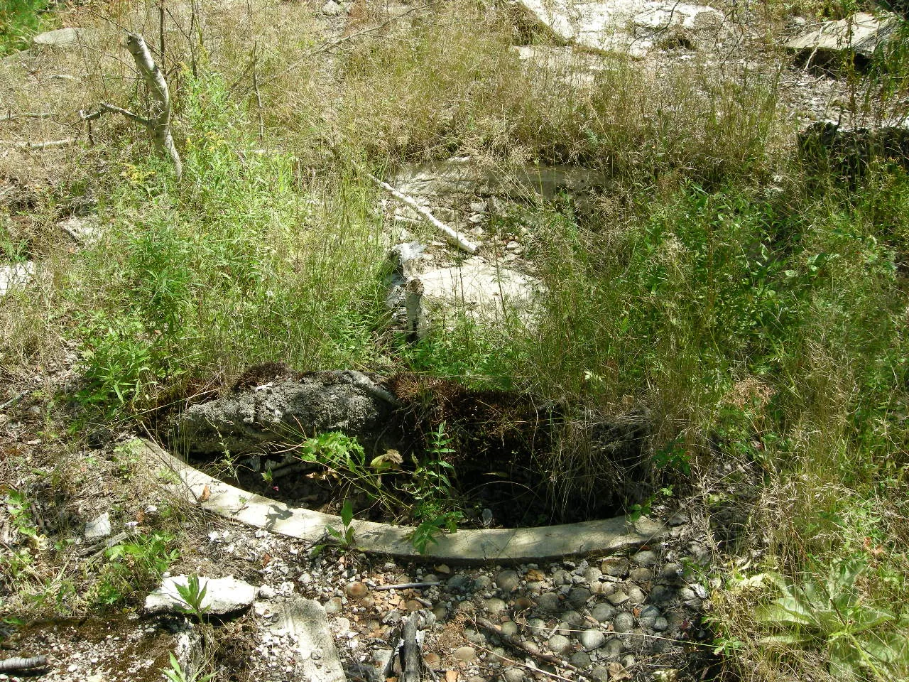
A circular concrete pool basin half filled with leaves and grass in a sunny clearing
The small circular pool beside the large fountain, 20 Aug 2009
3

Roof tiles and enameled brick

Found 19 and 22 August 2009 · Chicago tile, Newark brick

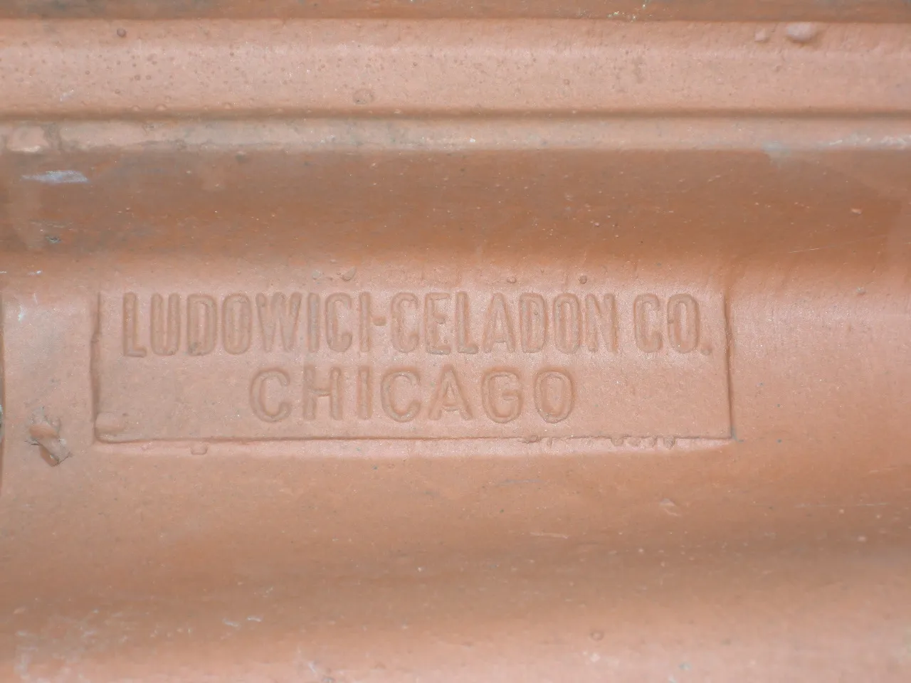
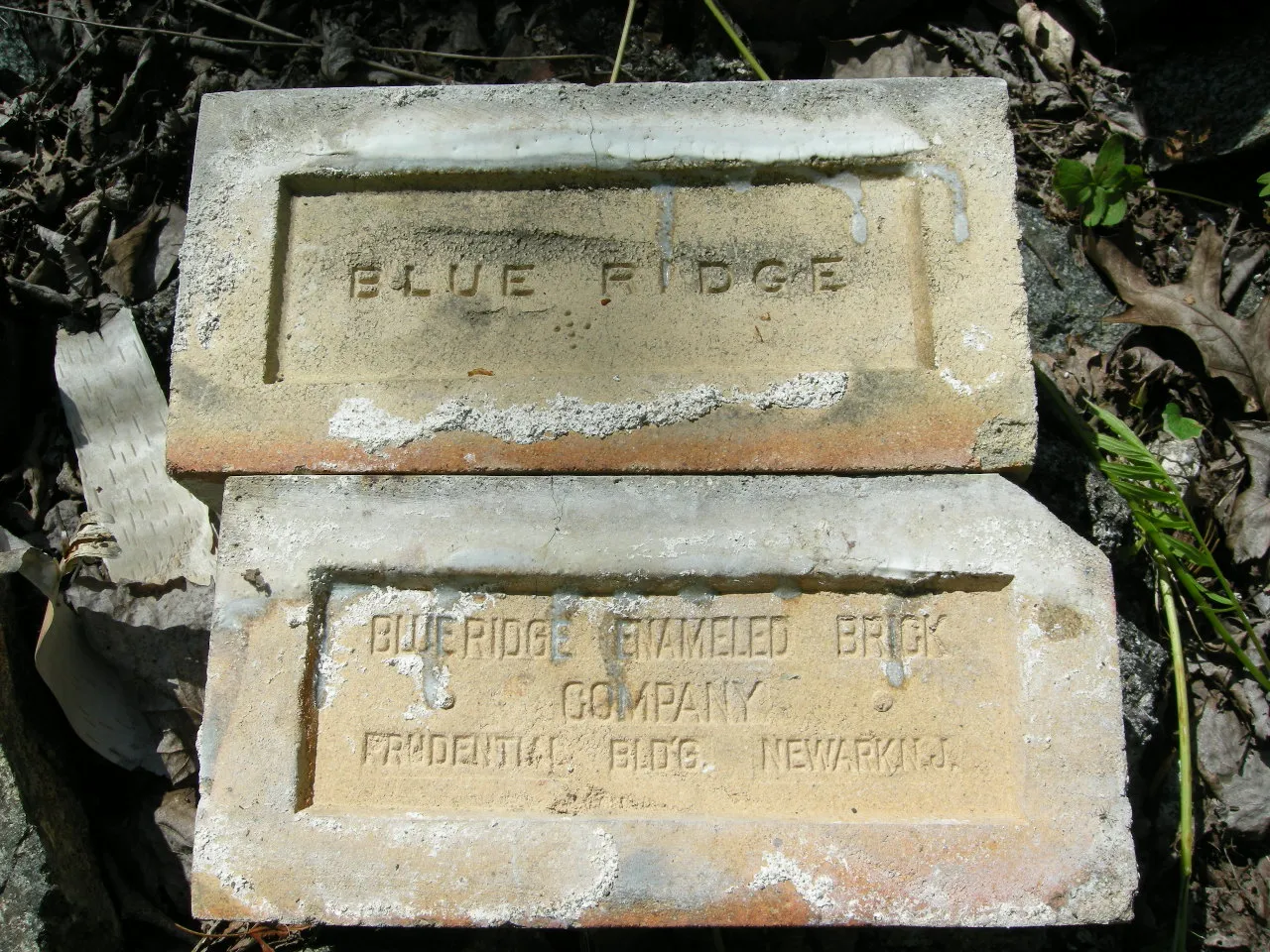
Downhill from the villa, near the road, the crew found a pile of broken red clay roof tiles. Several are stamped "Ludowici-Celadon Co. Chicago," the best-known American maker of clay roof tile in those years. Near the fountains lay white glazed bricks stamped "Blue Ridge Enameled Brick Company, Prudential Bldg., Newark, N.J." Red tile would suit an Italian villa, but we cannot say for certain which building on the estate these came from.

On 22 August a debris field turned up pieces of china, patterned tile, small ceramic figures and iron. Everything was photographed and left where it lay.

Found in the field · 19 and 22 August 2009

Close view of a red clay roof tile stamped Ludowici-Celadon Co. Chicago
A roof tile from the pile, stamped "Ludowici-Celadon Co. Chicago," 19 Aug 2009

The Saunderson years

Married 1906 · second lot bought 1906 · name restored 5 September 1922

In 1906 Archbold traveled through the Far East and became one of the first Western women to visit Tibet, where she met Armar Dayrolles Saunderson, son of the Irish Unionist leader Edward James Saunderson. They married that June on Cuttyhunk Island in Massachusetts. The same year How sold "Anne A. Saunderson" a second lot of 2.865 acres directly north of her first, surveyed by Edgar Lord on 16 August 1906. The couple bought Foxlease in Hampshire, England, and had four children: Lydia, Armar, John Dana, who was born at Bar Harbor in 1911, and Moira.

The marriage did not last. On 15 December 1919, in Portland, the children's nurse Eva Bennett and a Swiss governess, Louise Reber, gave sworn depositions taken at Mrs. Saunderson's request "in perpetual remembrance." Bennett had been with the family ten years. Both described Armar Saunderson's relationship with the family's French governess, which Bennett dated in part to the summer of 1914 at Bar Harbor. Saunderson was served notice and did not attend. The couple separated in 1922. Archbold left England with her children on a Standard Oil ship and gave Foxlease to the Girl Guides, and on 5 September 1922 the Probate Court at Ellsworth decreed that "the name of Anne Archbold Saunderson be changed to Anne Archbold, which shall hereafter be her legal name."

Equal rights

National Woman's Party deputation · 14 February 1924

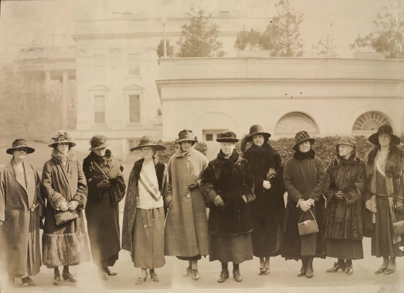
Back in America, Archbold settled in Washington, D.C., where she built Hillandale on Reservoir Road and in 1924, with the banker Charles C. Glover, gave the land that became Glover-Archbold Park. She joined the National Woman's Party and campaigned for the Equal Rights Amendment. On Valentine's Day 1924 ten New England members formed a deputation to the President to ask that Congress give the amendment full consideration. The photograph in the archive lists "Mrs. Anne Archbold, Maine" second from the left, next to Jessica Henderson of Brookline. Two other members of the group, Mrs. William Draper and Mrs. Ernest Schelling, were also listed from Maine, as was Gail Laughlin of Portland.

Ten women in hats and fur-trimmed coats standing in a row outside the White House
The National Woman's Party Valentine's Day deputation, 14 Feb 1924. Anne Archbold is second from left.
4

Barberry Ledge

Lot bought 30 Dec 1916 · 3 acres · garden by Beatrix Farrand, 1917

On 30 December 1916 How's heirs, Frank C. Bates and Samuel W. Bates, sold Frank Bailey Rowell and Christine Baker Rowell, "both of the Borough of Manhattan," three acres on Cleftstone Road. The lot began at a stone post 107 feet north of the line of "land of Anne M. Saunderson." The Rowells also received rights over Cleftstone Road, Devon Road, Acadia Lane and Acadia Landing, and the right to run drains and electric wires in a 20-foot strip between the Dimock and Auchincloss lands across the road.

The Maine Historic Preservation Commission lists a 1917 commission for the "Residence of Frank Bailey Rowell, Bar Harbor" among the works of Beatrix Farrand, the landscape architect of Reef Point and, later, Dumbarton Oaks. Frank Rowell served as secretary of the Bar Harbor Village Improvement Association, the society that built and kept the village paths. The 1941 Lynam real estate map lists the place as "Barberry Ledge," and on 22 August 2009 the crew logged a Japanese barberry still growing on the lot.

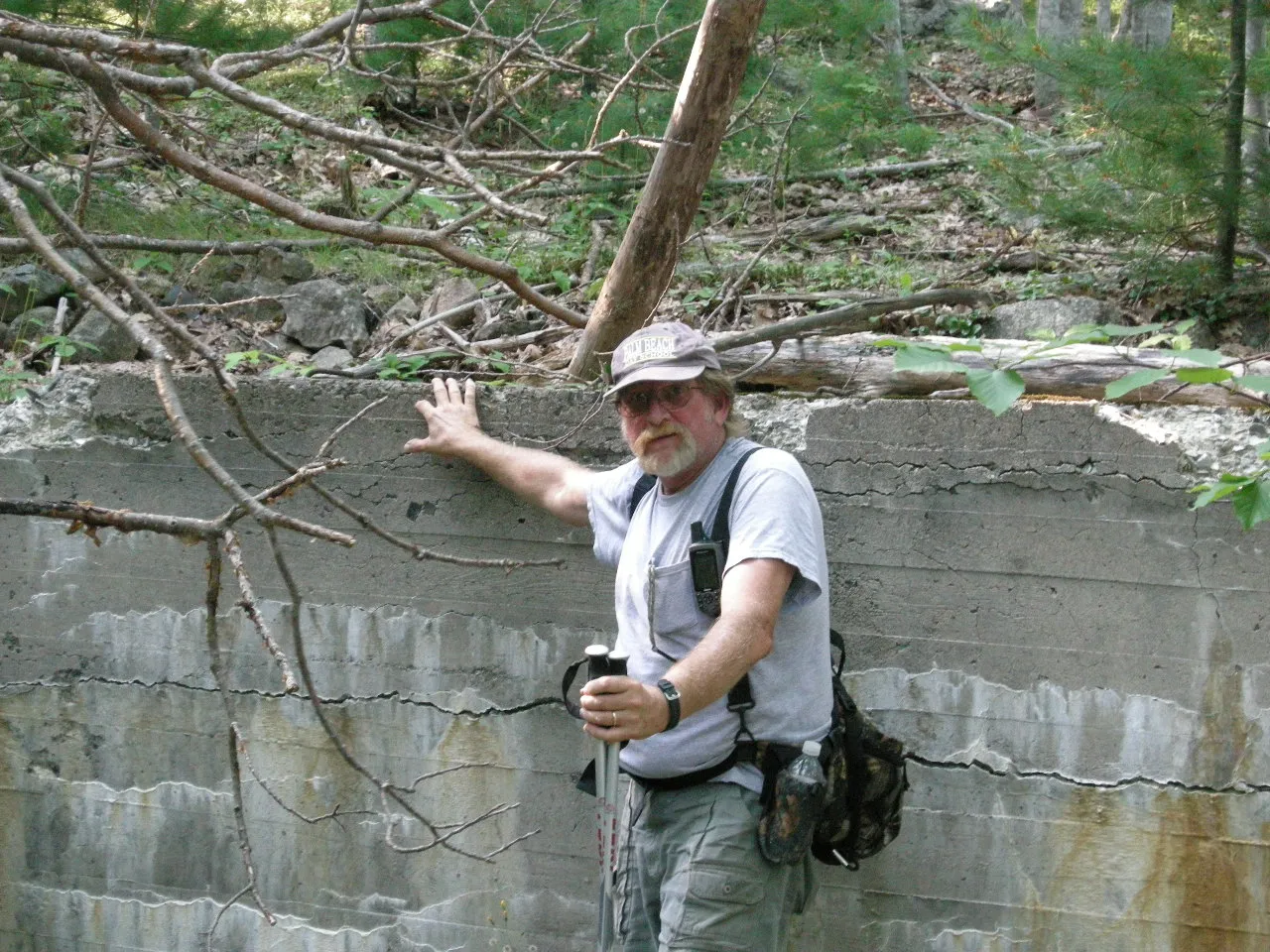
Our field notes recorded the foundation here as the Anne Archbold foundation. Measured along the road by the deed courses, though, it falls on the Rowell lot, and the Great Hill trail study reached the same conclusion: these are "the remains of the Rowell estate which was burned in the fire."

Found in the field · 17 to 22 August 2009

A crew member in a cap stands beside a tall concrete foundation wall in the woods
A crew member at the concrete foundation wall on the Rowell lot, 17 Aug 2009
5

The garage and the roads

Garage strip bought 21 Sep 1929 · 75 feet deep · re-deeded 4 Sep 1935

In 1929 the next generation of Bates heirs, Mary H., Van Ness H. and Paul Bates of Boston and Samuel W. Bates of Bar Harbor, sold the Rowells a strip 75 feet deep along the north side of their lot (Book 628, page 16). A second deed of 7 October 1929 confirmed their rights of way over Cleftstone Road, Acadia Lane and Acadia Landing. In the Drive folder the first deed is filed as the "garage" deed.

On 4 September 1935 the Rowells deeded the lot to Dorothy C. Carroll of Ellsworth, and she deeded it straight back to them on the same day. Each deed was for a dollar "but not more than one hundred dollars," and the return deed made the couple joint tenants, with the land passing to the survivor. Frank Rowell's will was proved on 1 June 1937, and he left everything to Christine.

Found in the field · 19 August 2009

  • The garage, poured concrete Show on map
  • A stone foundation with a concrete pad and a drain hole in its center, and the 8 to 12-inch clay drain that "comes out of side of creek bed from the garage pad" Show on map
  • The old road Show on map and road end Show on map
  • A road that "seems to start as a path from house foundation and widens to a road" Show on map
Low poured concrete foundation walls of a garage among young trees
The poured concrete garage at the north end of the Rowell land, 19 Aug 2009
6

Rockefeller's boundary markers

Bates land to George B. Dorr 21 Sep 1929 · then to John D. Rockefeller Jr.

The same day they sold the garage strip, the Bates family sold George B. Dorr, the father of Acadia National Park, the land around the Rowells. Its bounds ran from the New Eagle Lake Road along Bloomfield Road and Cleftstone Road to "land of Frank Bailey Rowell and Christine Baker Rowell," then around the Rowell lot by four courses to stone bounds and back to Cleftstone Road. Dorr passed the land to John D. Rockefeller Jr., as he did with many parcels he gathered for the park. By 1949 the United States owned the land on three sides of the Rowell lot.

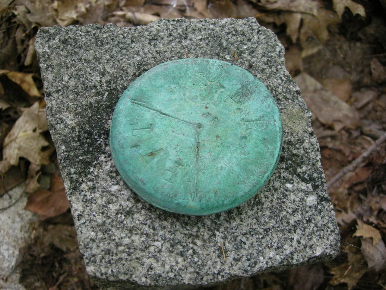
Between 22 and 31 August 2009 the crew searched for those lines and found four "JDR" boundary markers, a bronze disc set in granite and several plain boundary stones. One short stone, "almost buried," was found by projecting a compass line from JDR marker 1.

Found in the field · 22 to 31 August 2009

A green bronze survey disc set in a square granite block among dry leaves
The bronze disc at JDR marker 1, 22 Aug 2009
7

Twenty steps to the Overlook

Cleftstone Road to Overlook Path · on the 1896 map · 0.22 mile

The estates were built against one of Bar Harbor's oldest path systems. The 1896 path map shows a trail from Bloomfield Road, opposite Woodbury Park, climbing to the Overlook on Great Hill and coming down to Cleftstone Road. That lower end began about a quarter mile north of the Eagle Lake Road, at a flight of about 20 stone steps leading diagonally up the bank. From the top it ran west, past an old cairn, to the concrete foundation of the Rowell garage, then turned north on a faint woods road.

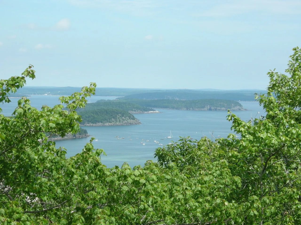
The Great Hill study suggests the path first ran diagonally across what became the Rowell land and was moved to the steps along the property line when the estate was built. Since the early 1950s the Paradise Hill Road has cut through the slope below the Overlook, but walkers can still cross it and scramble up to the ledge, which has a view over Bar Harbor and the Porcupine Islands.

Found in the field · 12 to 27 August 2009

  • "Steps 20: beginning of Great Hill path," 17 August
  • A possible step location nearby Show on map
  • A "big flat area above road at base of fill" Show on map
  • The lookout, a "ledge with good view over Bar Harbor" Show on map
  • The trail at the old Champlain Road Show on map
View from a wooded ledge over Frenchman Bay and its islands
Frenchman Bay from the ledges of Great Hill, 12 Aug 2009
8

Great Hill in 2009

Field days 11, 12, 17 and 27 August 2009 · summits at 526 feet

In the 1890s Great Hill was a popular walk. The 1891 report of the Bar Harbor Village Improvement Association lists the Royal Fern Path and the Bracken Path, which circled its base and may be two of the oldest planned trails on Mount Desert. Paths over the two summits followed between 1896 and 1901, and the 1915 Path Guide describes them as its first walk. None were reopened after the 1947 fire. In 2007 the park removed a network of rogue trails here, and some historic cairns may have been lost with them.

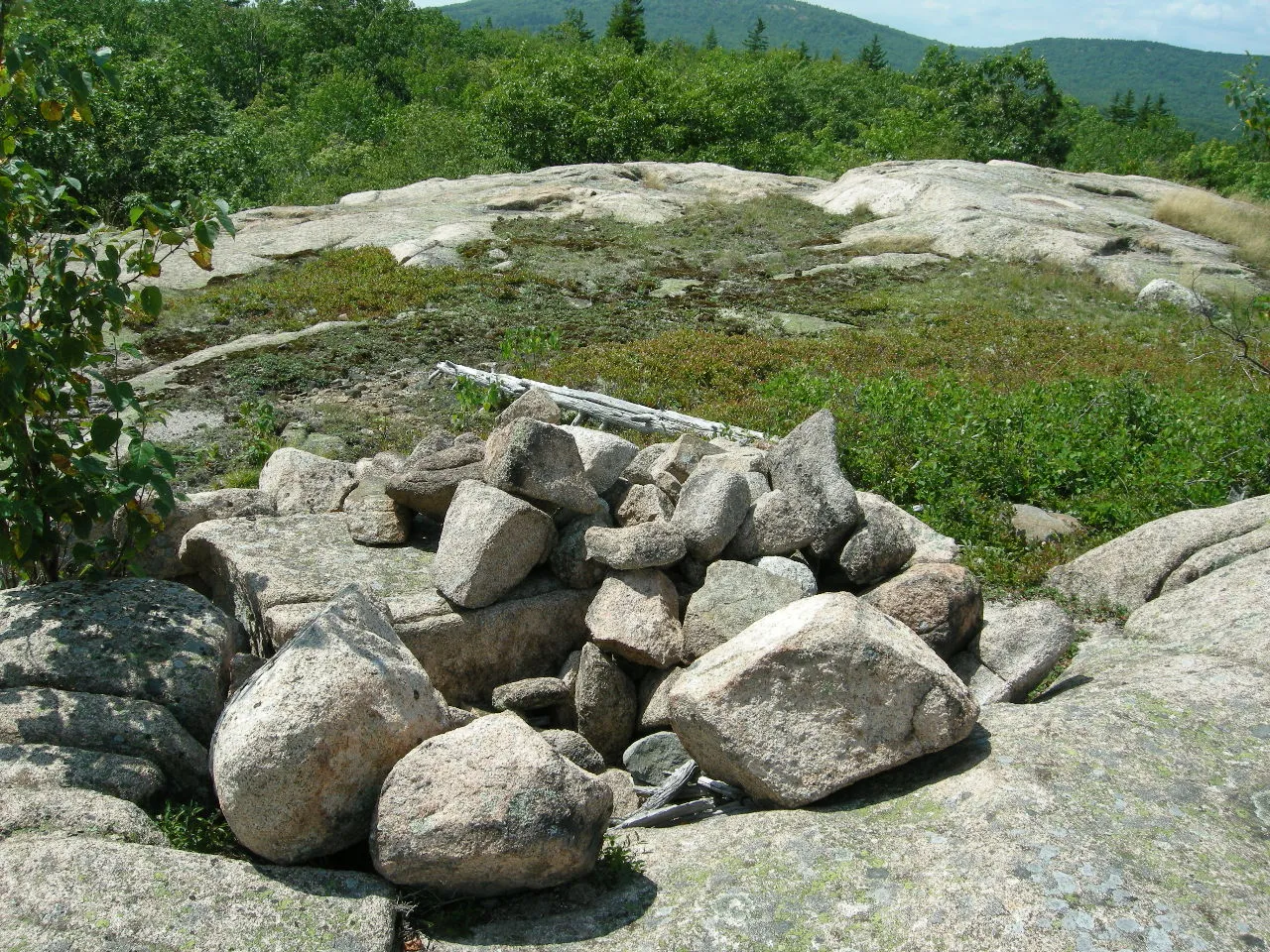
In August 2009, over the same weeks as the estate survey, the crew worked across the hill with the 1942 map: the Southwest Trail down to the Bracken Path, the junction of the Bracken and Fawn Pond paths, the old water company road, and a beaver pond at the western foot. They noted steps that "may be natural but looked placed to me," an old tree "jammed and propped into rocks sticking straight up" as a pole marker, a run of cairns leading northwest and "a lot of old wire here. Telephone line?"

Found in the field · August 2009

A low cairn of rounded stones on open granite ledge
A cairn on the open ledges of Great Hill, 12 Aug 2009

Fire, gift and sale

October 1947 fire · Rowell gift 23 Jun 1949 · park purchase 1989

The fire of October 1947 burned both houses. Christine Rowell, by then of New York City, gave the four Rowell parcels to the United States on 23 June 1949 as "an absolute and unconditional gift" for the extension and improvement of the park.

The Archbold land took forty more years to follow. Anne Archbold had deeded the 1906 lot to her son John on 30 September 1940 and the 1902 lot to John D. Archbold on 9 April 1948. In 1974 John D. Archbold of Upperville, Virginia, transferred the land to the Archbold Investment Company, a family partnership in Washington, which in 1979 deeded both lots to the Jackson Laboratory. Anne Archbold died at her winter home in Nassau on 26 March 1968. In 1989 the Jackson Laboratory sold the lots to the United States for $92,000 as Tract 108-15, Acadia National Park, 5.87 acres, "for the use of and the development by the National Park Service."

From the field

More photographs, August 2009

All photographs were taken by the field crew on the estates between 19 and 22 August 2009.

A curving concrete staircase overgrown with ferns and saplings
The double staircase up to the villa, 20 Aug 2009
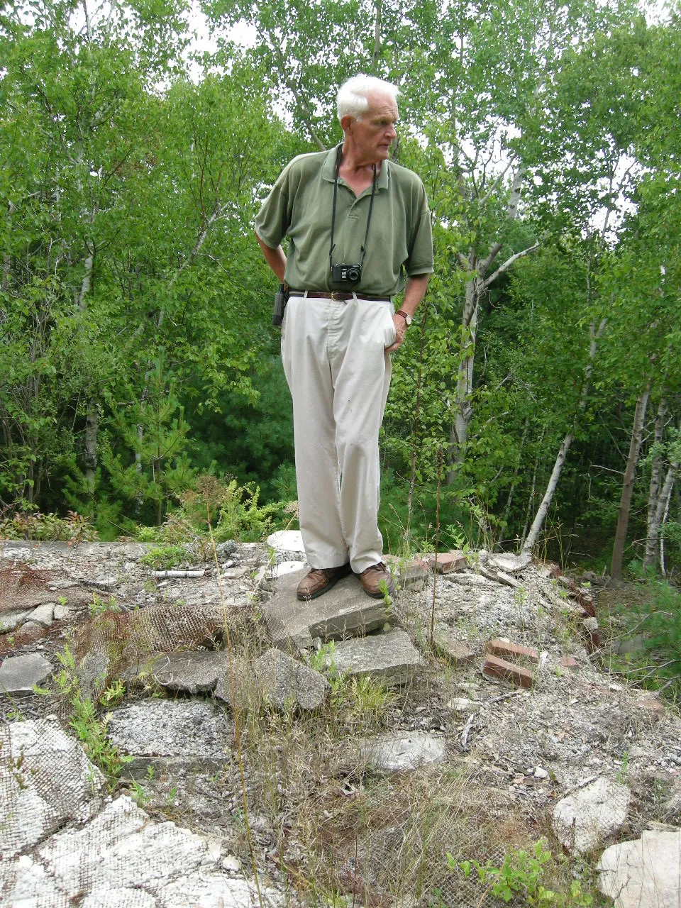
A white-haired crew member standing at the foot of a weathered stucco wall
A crew member at a villa wall, 22 Aug 2009
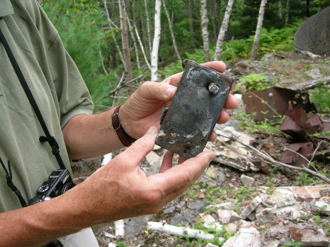
Hands holding a small rusted metal object above a debris field
A find from the debris field, photographed and put back, 22 Aug 2009
Two white glazed bricks stamped Blue Ridge Enameled Brick Company, Prudential Bldg, Newark NJ
Bricks stamped "Blue Ridge Enameled Brick Company, Newark," 20 Aug 2009
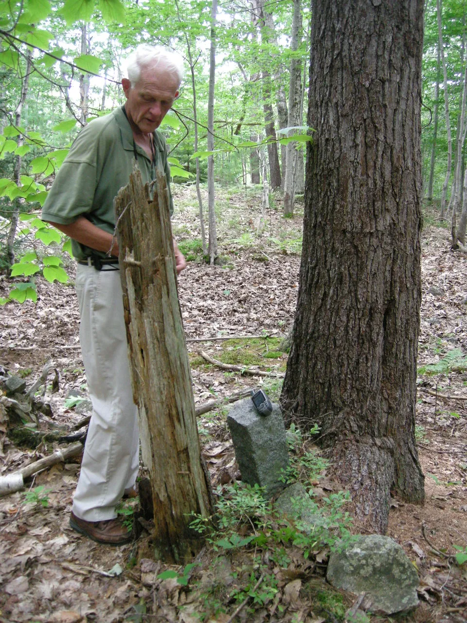
A white-haired crew member beside a broken stump and a small granite boundary stone with a GPS unit on it
A crew member beside a boundary stone, with the GPS unit set on top, 22 Aug 2009
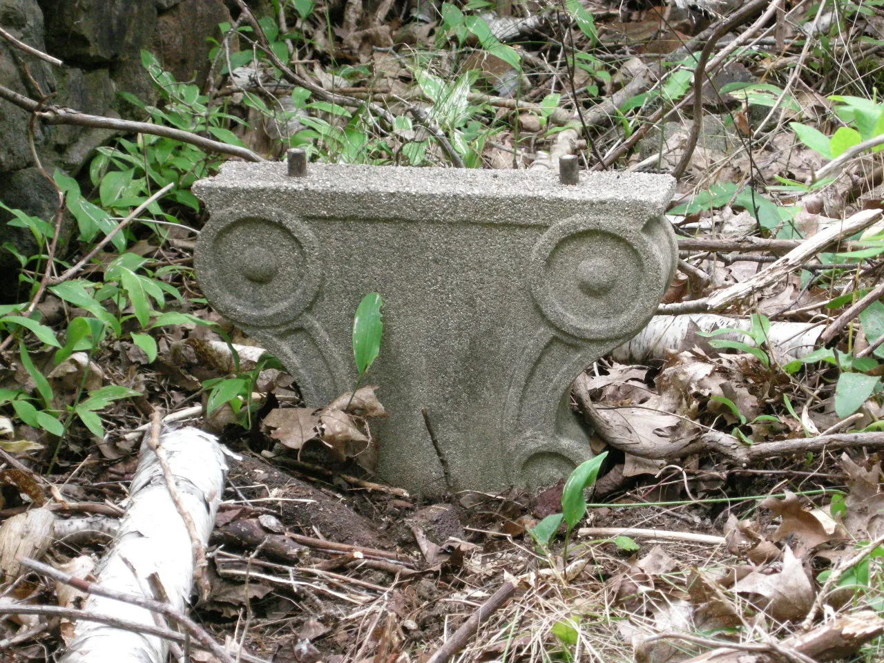
A carved stone capital with scroll ends lying in leaves
A carved stone capital near the old road, 19 Aug 2009
Timeline

Cleftstone Road in fourteen dates

  1. 1880s–1896Charles T. How lays out Cleftstone, Bloomfield, Woodbury and Devon roads.
  2. 8 Nov 1902How sells Anne M. Archbold three acres on Cleftstone Road.
  3. 1903–1904The Archbold villa is built, designed with Fred Savage and Janet Scudder.
  4. 1906Anne Archbold marries Armar Saunderson and buys a second lot of 2.865 acres.
  5. Oct 1909Charles T. How dies; the Bates family administer his land.
  6. 30 Dec 1916The Bates heirs sell Frank Bailey and Christine Baker Rowell three acres next door.
  7. 1917Beatrix Farrand's commission for the Rowell residence.
  8. 15 Dec 1919The household staff give depositions in Portland.
  9. 5 Sep 1922The Probate Court at Ellsworth restores the name Anne Archbold.
  10. 21 Sep 1929The Rowells buy the garage strip; George B. Dorr buys the land around them.
  11. Oct 1947Fire burns the Archbold villa and Barberry Ledge.
  12. 23 Jun 1949Christine Rowell gives the Rowell land to the United States.
  13. 1989The Jackson Laboratory sells the Archbold lots to the park, 5.87 acres, for $92,000.
  14. Aug 2009Our crew maps the fountains, foundations, boundary stones and Great Hill paths.
From the archive

Deeds, court papers and maps

The documents behind this story, all in the Library.

Further reading: A Biographical Dictionary of Architects in Maine: landscape architects (Maine Historic Preservation Commission) and the 1928 Annual Report of the Bar Harbor Village Improvement Association (The History Trust). This page was researched and drafted with AI assistance from the deeds, court papers and field records, and reviewed by the Lost Trails crew.

Walk lightly

The estate ruins are inside Acadia National Park, and the houses along Cleftstone Road are private. The walls and stairs are crumbling, so look and photograph from a safe distance, and leave tiles, bricks and every other find where it lies; removing artifacts from park land is against federal law.