Old path guides, maps and the field files behind the Atlas
The trails on this site were found by reading old guides against the ground. The shelf is arranged by kind: maps, books and guidebooks, park histories, Les Heilakka’s research notes, deeds and surveys, local histories, newspaper clippings, reports and records, and the GPS field data. Each published entry links to a public scan or the publishing institution.
Maps
The 1942 base map behind the Atlas, the old path maps and island maps it was read against, and map scans and aerials from the field archive.
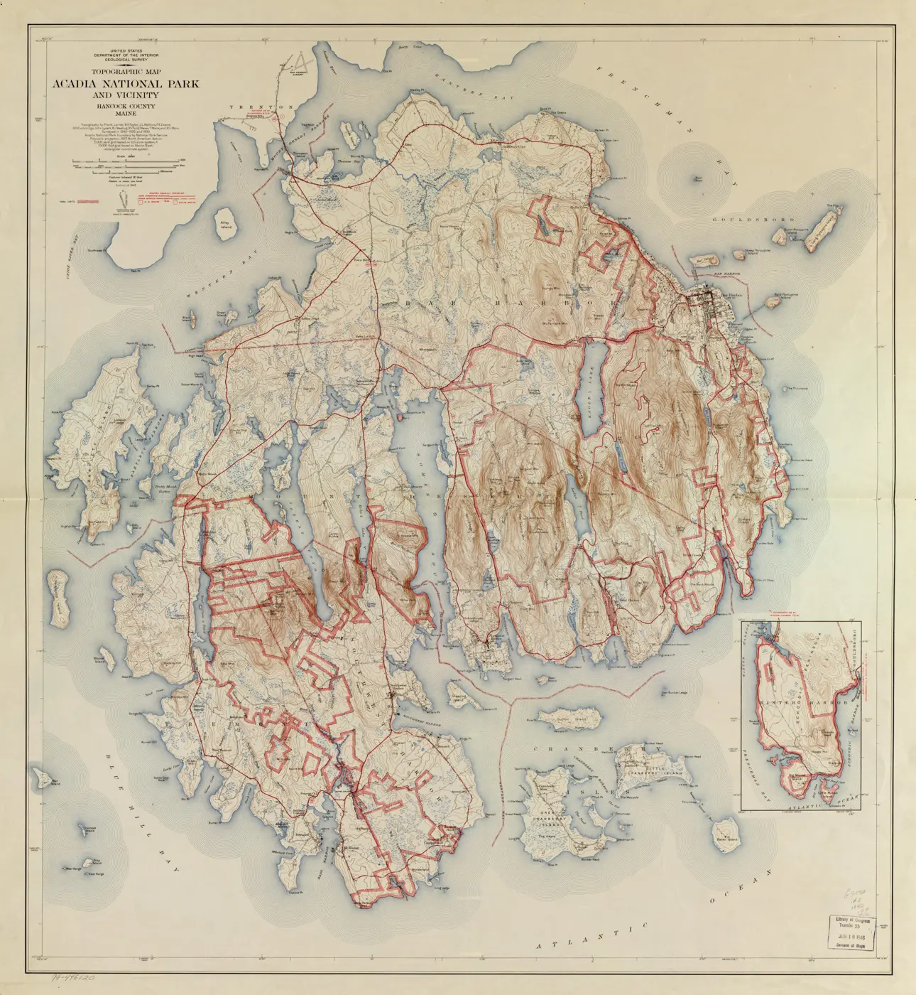
Acadia National Park and Vicinity, 1942
Topography by Frank Larner, B. P. Taylor, J. L. Watkins and seven others, surveyed in 1934–1935 and 1939, with the park boundary supplied by the National Park Service. Scale 1:31,680 — two inches to the mile — which is why the old woods roads and footpaths survive on it in such detail.
The Library of Congress copy, stamped as a 1946 transfer to its Division of Maps, is the scan used here.
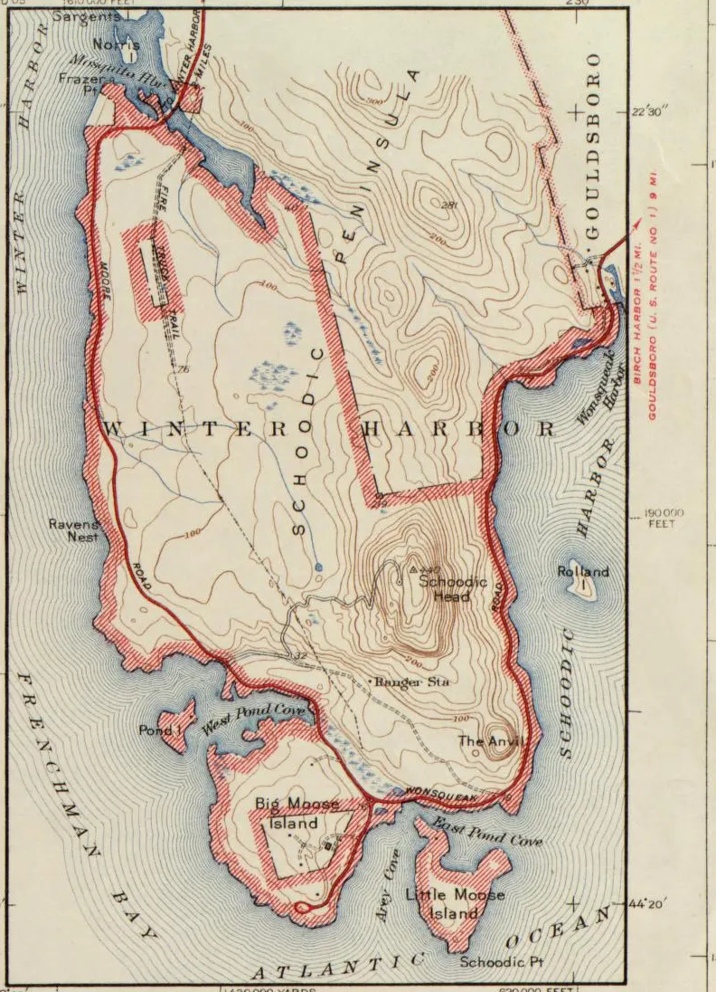
Historic maps
Map scans & aerials from the field archive
Books & guidebooks
Victorian guidebooks, the path guides and walking books of the Village Improvement Societies, and the island histories that describe the old routes. Several can be read here as PDFs.
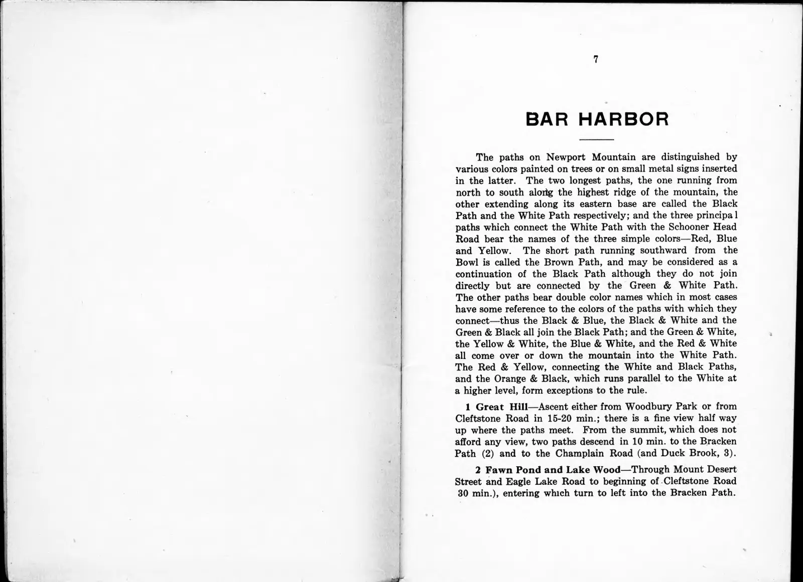
A Path Guide of Mount Desert Island, 1915
Bates, Rand and Jaques’s guide for the four Village Improvement Societies — every page, searchable, with an index of its 141 numbered routes and trails, linked to tracks in the Atlas.
Open the 1915 guide →Park & trail histories
National Park Service histories, engineering records, National Register nominations and management plans for the trail, carriage-road and motor-road systems, with George B. Dorr’s letters.
Research notes
Les Heilakka’s own write-ups, waypoint tables, route sheets and working spreadsheets, gathered area by area alongside the GPS field work. Word and Excel files are shown as PDFs.
Deeds, surveys & property
Deeds and deed abstracts, surveys, lot plans, tax cards and land-transfer records used to place old paths, house sites and estate boundaries.
Local histories & articles
Written histories of particular places — the Bar Harbor Water Company, Browns Mountain, the Eagle Lake and Schooner Head properties — with journal articles on island place-names and institutions.
Newspaper clippings
Bar Harbor Times and Mount Desert Islander pieces on old roads, bridges, the cog railway, Seal Cove, the pest houses and other places in the field archive.
Reports & records
Park Service landscape inventories and engineering records, state and town annual reports, land-purchase memoranda and correspondence.
Old names, new names
Most of the island’s mountains carried different names until 1918–19, when George B. Dorr persuaded the U.S. Board on Geographic Names to rename about a dozen of them for the French and English history of the coast. The 1915 Path Guide and many old deeds use the old names. Throughout this site, listings that mention a renamed mountain show the other name in rust-colored type.
| Name today | Name before 1918 | Notes |
|---|---|---|
| Acadia Mountain | Robinson Mountain | Robinson was an early settler said to have dug for Captain Kidd’s treasure. |
| Bernard Mountain | Western Mountain (west peak) | For Sir Francis Bernard, colonial governor of Massachusetts Bay. |
| Brewer Mountain | Interlaken Hill | Not one of Dorr’s changes. Interlaken Hill from at least 1874 (and in the 1915 Path Guide), then “Dan Brewers Mt” on the 1896 Bates–Rand–Jaques path map, for Daniel Brewer, who owned it. The Board on Geographic Names approved “Brewer” in 1928. Quarried for granite by his son Frank, about 1905–09. |
| Cadillac Mountain | Green Mountain | Earlier also Newport Mountain (1850s). Renamed 1918 for Antoine Laumet, Sieur de Cadillac. |
| Champlain Mountain | Newport Mountain | For Samuel de Champlain, who named the island in 1604. |
| Dorr Mountain | Dry Mountain | Flying Squadron Mountain from 1918, honoring World War I aviators; later renamed for George B. Dorr. |
| Huguenot Head | Picket Mountain | The summit just west of Champlain. |
| Mansell Mountain | Western Mountain (east peak) | For Sir Robert Mansell, English vice admiral. |
| Norumbega Mountain | Brown Mountain | Called Mount Mansell in an 1869 book by Rev. B. F. De Costa, but that name never caught on. |
| Parkman Mountain | Little Brown Mountain | For historian Francis Parkman, at Charles W. Eliot’s suggestion. |
| Penobscot Mountain | Jordan Mountain | Rises from the west shore of Jordan Pond. |
| Sargent Mountain | (unchanged) | Fishermen knew it as Brassy Mountain for its color seen from the sea. |
| St. Sauveur Mountain | Dog Mountain | Called Defile Mountain on the 1872 Dodge map. |
Sources: NPS, “Secrets of the Summit”; National Parks Association, Lafayette National Park analysis (1924); “Real and Imagined France in Acadia National Park” (NPS, 2017); Acadia on My Mind, “The 26 peaks of Acadia” and its account of the renamings; Don Lenahan’s 2014 post on Brewer Mountain in The Memorials of Acadia National Park.
Online collections
Archives and catalogues worth searching for more: historical maps, topographic quadrangles, newspapers and the park’s memorials.
Field data
GPX from the “My Maps” field archive, with duplicate copies removed. Track and waypoint names are kept exactly as recorded in ExpertGPS, and each track keeps a note of the source file and folder it came from. Open them in any GPS or mapping application.
| Area | Section | Tracks | Miles | Download |
|---|