Lost Trails and Paths of Acadia · Features
Talks & Videos
Illustrated lectures on the history of Mount Desert Island
delivered by
Terese Miller
Historian, Lecturer, and Guide on the Old Paths
Terese Miller has spent years in the deeds, the old newspapers and the woods, and has given many talks on Mount Desert Island history (Southwest Harbor Public Library). The recordings below are shown here with her permission and are arranged in the order they were given.
Of the Lecturer
Boards, societies and the hiking trail
Boards & Societies
- Board member, Tremont Historical Society
- Primary representative, The History Trust
- Guest lecturer, Bar Harbor Historical Society
- Instructor, Acadia Senior College
- Boat-excursion guide, Sail Acadia, Southwest Harbor
- Twenty years in Mount Desert Island grade-school education, now retired From her Acadia Senior College profile
On the Trail
- Volunteer lecturer, Acadia National Park "Historical Hikes" Acadia Senior College
- Guide, with Gary Stellpflug, to the granite bench off the Kane Path above The Tarn, which she believes the Kane Path crew built under George B. Dorr Acadia on My Mind, April 2026
- In the field with the Lost Trails crew on Western Mountain, 27 September 2022, where she read a stand of evenly rowed pines as a likely CCC planting Field waypoint "Pine Plant"
- Researcher, thanked on this site as "an incredible researcher" Welcome page
Programme
Recorded lectures, 2021 to 2026
-
I.Women of Acadia48 min.
Terese Miller, a Bar Harbor researcher, on some of the remarkable women who were instrumental in shaping the Acadia National Park we know today, giving land, money and years of work to the paths and the park (Bar Harbor Historical Society).
On this site: Eliza Homans and the Homans House, in After the Fire of '47, and the Homans Path trailhead and the Kane Path in the Atlas.
Recording: Bar Harbor Historical Society, on YouTube -
II.Pest Houses: Quarantine in the Early 20th Century31 min.
A lecture prepared by David Goodrich and presented by Terese Miller. It compares the control of COVID-19 with the control of typhoid in Bar Harbor in the early 1900s (Bar Harbor Historical Society).
On this site: The Pest Houses of Bar Harbor, the three isolation-hospital sites found again from Goodrich's research.
Recording: Bar Harbor Historical Society, on YouTube -
III.The Transformation of Bar Island47 min.
Terese Miller, Mount Desert Island teacher and historian, on the history of Bar Island, the tidal island joined to Bar Harbor by a gravel bar at low water (Bar Harbor Historical Society).
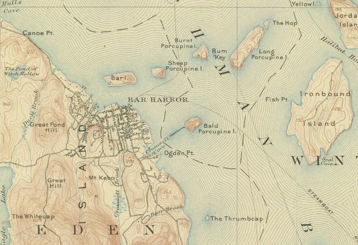
On this site: Bar Island lies just off the Bar Harbor shore in the 1904 map at the top of this page; see also The Bar Harbor Water Company and From Golden Age to Lost Remains.
Recording: Bar Harbor Historical Society, on YouTube -
IV.The Mills of Mount Desert Island62 min.
From the first pioneer families of 1762, free and renewable water power ran the mills that gave the island's settlements their food, clothing, shelter and transportation. Terese Miller looks at the mill sites, what they made and the families who ran them across Mount Desert Island from 1762 until the early 1900s (MDI Historical Society).
Near the end she follows one family, the Heaths of Seal Cove, from the sawmill William Heath took over on Seal Cove stream in 1789 to the end of water-powered milling there, a story told in full in VI, below (Southwest Harbor Public Library).
On this site: mill dams and sites in the Historic Features index.
Recording: Southwest Harbor Public Library, on YouTube -
V.Stories from the Factory Floor: The Quiet Side's Sardine History62 min.
Terese Miller and reporter Nan Lincoln pair vintage photographs with a history of the two largest canneries on the Quiet Side: the Underwood factory in Bass Harbor and Stinson's in Southwest Harbor. Members and friends of the historical society read recollections, and former Stinson's manager Peter Colson and former line worker Rita Pollard share their own memories (Southwest Harbor Public Library, event listing).
Recording: Southwest Harbor Public Library, on YouTube -
VI.A Timely Tale of Shifting Economies: The Heath Family of Seal Cove84 slidesSlides prepared
From 1789 until 1962, four generations of the Heath family lived in the same house at Seal Cove. Terese Miller follows them through deeds, tax lists, census returns, ship papers, letters and old newspapers to tell the rise and fall of one Tremont family, and with it the story of a town economy changing around them.
William Heath, a New Hampshire drummer and fifer in the Revolutionary War, married Hannah Allen at Sedgwick and settled at Seal Cove in 1789, buying land where Abraham Reed had built a mill. His son, Capt. William Heath, Jr. (1793–1864), ran the family's carding, grist and saw mills on Seal Cove stream and its store, and built and sailed vessels such as the schooner Orator and the brig Etrurian. Shipwrecks, lawsuits and the coming of the railroads ended that trade, and in 1856 and 1857 he sold half the sawmill to Ezra Reed and the house lot and mill privilege to his son.
His son, William Webster Allen Heath (1834–1912), the last Heath to run the sawmill, made his way as a civil engineer, surveyor and teacher, a selectman and a state senator. The fourth generation, Julien, Fred, Louisa and Victor, worked as a musician and storekeeper, a painter, a schoolteacher and a farmer in the new summer-visitor economy. The family lost the homestead to a tax lien in 1927, and Victor, the last of them, died in 1962. The talk ends with a question for Tremont today: what can one family's shifting fortunes teach a town whose economy is changing again?
On this site: the Heath Cemetery and the site of the old Seal Cove Bridge in the Atlas, and IV. The Mills of Mount Desert Island, above.
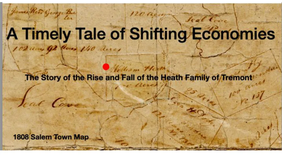 Title slide, over the 1808 Salem town map. Slides: Terese Miller
Notes & Rights
This page is published with Terese Miller's permission. The recordings belong to the organizations that made them and to the speakers. They play from those organizations' own YouTube channels and are not copied to this site. A video loads only when you press play, using YouTube's privacy-enhanced mode.
The map is a detail of the U.S. Geological Survey Bar Harbor quadrangle of 1904, a U.S. government work in the public domain, from this site's Library.
This page was drafted with AI assistance from the published talk listings and our field records, and reviewed by the Lost Trails crew.