Historic features · Featured story

After the Fire of '47

How one October remade Acadia

On the afternoon of 17 October 1947 a small fire in the dry marsh grass at Fresh Meadow was the least of anyone's worries. Ten days later it had crossed most of eastern Mount Desert Island, burned more than 17,000 acres, and left behind a different Acadia.

This story follows the fire across the paths, roads and forests in this atlas, using the National Park Service's own day-by-day map of the burn, its 1948 report on the damage, and what the Lost Trails crew has found in the woods since.

Black and white photograph of North Bubble after the fire, its slopes covered in standing dead and fallen trees, with leafless hardwoods in the foreground
North Bubble after the fire, 1947. Photo by Paul G. Favour Jr., National Park Service.
Ten days on a map

The burn, day by day, over the Atlas

In 1990 the Park Service digitized the burn into a GIS map, divided by day. Here it is laid over the 1942 USGS sheet, with every lost trail and old road in the Atlas that runs into the burn. Pick a day, or press Play. Numbered pins are the stops in this story.

Lost or abandoned trail Old road or grade Story stop Burn areas: NPS, The Great Fire of 1947, Mount Desert Island (fire47), 1990.
DaysAcres, NPS GIS mapWhat the Park Service published
17–20 Oct153"only 169 acres" in the first three days
21 Oct2,015"over 2,000 acres"
22 Oct2,109"nearly 2,300 acres"
23 Oct10,710none given
24–27 Oct2,013"almost 2,000 more acres"
Total17,00117,188 acres

Published figures from the National Park Service and its 2008 fire brochure. The GIS map and the published total agree to within about one percent. Totals for the island run from 17,128 to 18,560 acres, because Park Service reports from 1948 and 1950 disagreed (Friends of Acadia).

128 of 308miles of lost and abandoned trail in the Atlas lie inside the burn
95 of 241miles of old roads and grades
686of the 1,705 historic features we have recorded
530of those in ground that burned on 23 October alone

The 686 features inside the burn include 203 sets of steps and trail stonework, 158 boundary markers, 60 bridges, 49 cellar holes and 47 dams and waterworks.

1

Smoke at Fresh Meadow

Friday, 17 October 1947 · 4:05 p.m.

At 4:05 p.m. on Friday, 17 October 1947, the Bar Harbor Fire Department took a call from Dolliver's Dump. The dump sat on the south bank of Fresh Meadow, a bog on the Crooked Road about seven miles northwest of the village. The driver sent out with the department's Dodge forest fire truck found about an acre burning in dry marsh grass, 30 to 50 feet off the edge of the bog. His truck carried a 150-gallon tank. When it ran dry he had to drive about a mile to a brook to refill it.

"As we were too painfully aware, the conditions were ripe for a major fire. We had gone several months without rain and all vegetation was dehydrated to a point that any fire, no matter how small, could in a short time, if not soon contained, get completely out of hand."Bar Harbor Fire Department, "The Bar Harbor Fire, 1947"

The wind that afternoon was light, from the southwest. Fire Chief David Sleeper called Acadia National Park for help at 4:45. By noon the next day crews had held the fire to about 100 acres, and they patrolled it through 20 October (NWCG staff ride). In its first three days the fire blackened only 169 acres (NPS).

2

The island before the fire

The 1942 map · CCC work, 1933 to 1942

The 1942 USGS sheet that underlies this atlas shows the island five years before the fire. Most of eastern Mount Desert was conifer forest: spruce and fir, with white pine and pitch pine on the ledges (NPCA). Through it ran the network of paths the village improvement societies had built and mapped since the late 1800s. The 1915 Path Guide describes walks such as "Around the Bubbles": out by the Seaside Path to Jordan Pond, along the east shore, by the carry to Eagle Lake, and across the south end of Burnt Bubble.

The Civilian Conservation Corps had worked in these woods from 1933 to 1942, clearing logging slash and windthrown trees and cutting firebreaks. The Park Service's 1948 report credits that work: it "unquestionably reduced rate of spread after the blow-up subsided" (NPCA, quoting the 1948 report).

Found in the field · 2009 to 2015

  • McFarland's Path crosses a firebreak, 30 August 2009 Show on map
  • A firebreak leading west off the Eagle Lake carriage road that "looks like a road or trail," 27 August 2015 Show on map, and another going west Show on map
  • An "Old Fire Lookout, in ruins," 14 August 2009 Show on map
3

The blow-up of October 23

21 to 27 October · out 14 November

On 21 October strong winds drove the fire out of control (NPS). National Park Service firefighters, flown in for the purpose, stopped its western advance with a backfire at Aunt Betty Pond (NPS Multiple Property Documentation).

Then, on 23 October, the wind shifted and the fire became what the press called a "gale-driven inferno." It raced northeast to Hulls Cove and forced the village to evacuate. It then turned south and east, barely missing downtown Bar Harbor but destroying hotels and mansions in its path. It finally reached the sea, having consumed most of the forest from Sieur de Monts Spring to the edge of Otter Cliffs (NPS). In less than three hours it travelled six miles and left a path of destruction three miles wide (NPS).

With the roads out of Bar Harbor blocked by flames, local fishermen took at least 400 people off by boat. A bulldozed path along Route 3 finally let cars carrying 2,000 more people escape the island. Sixty-seven seasonal estates on "Millionaires' Row," 170 permanent homes and five large hotels were destroyed (NPS).

On the GIS map, 23 October alone accounts for about 10,700 acres, nearly two-thirds of the whole burn. On the afternoon of 24 October, Park Naturalist Paul Favour flew over the fire and sketched its edge onto topographic maps (Acadia archives finding aid). The fire was declared under control on 27 October, but it smoldered underground and was not pronounced out until 4 p.m. on 14 November (NPS).

Burned house lots in Bar Harbor after the fire, with fire-killed trees in front and the shells of large hotels on the hill behind
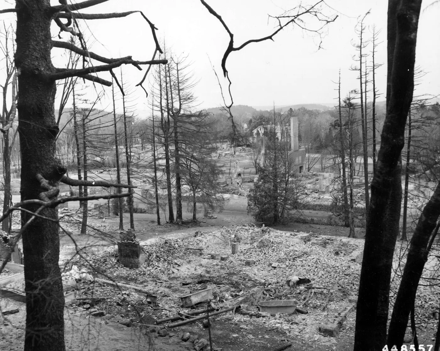
Ruins at Bar Harbor. Homes in foreground – hotels background.Photo by Bluford Muir, U.S. Forest Service, 28 October 1947. National Archives, NAID 7104876 (Wikimedia Commons). U.S. government work, public domain.
A man standing beside the chimney and burned debris of a house on Eagle Lake Road, with the road, bare lots and a stand of pines behind
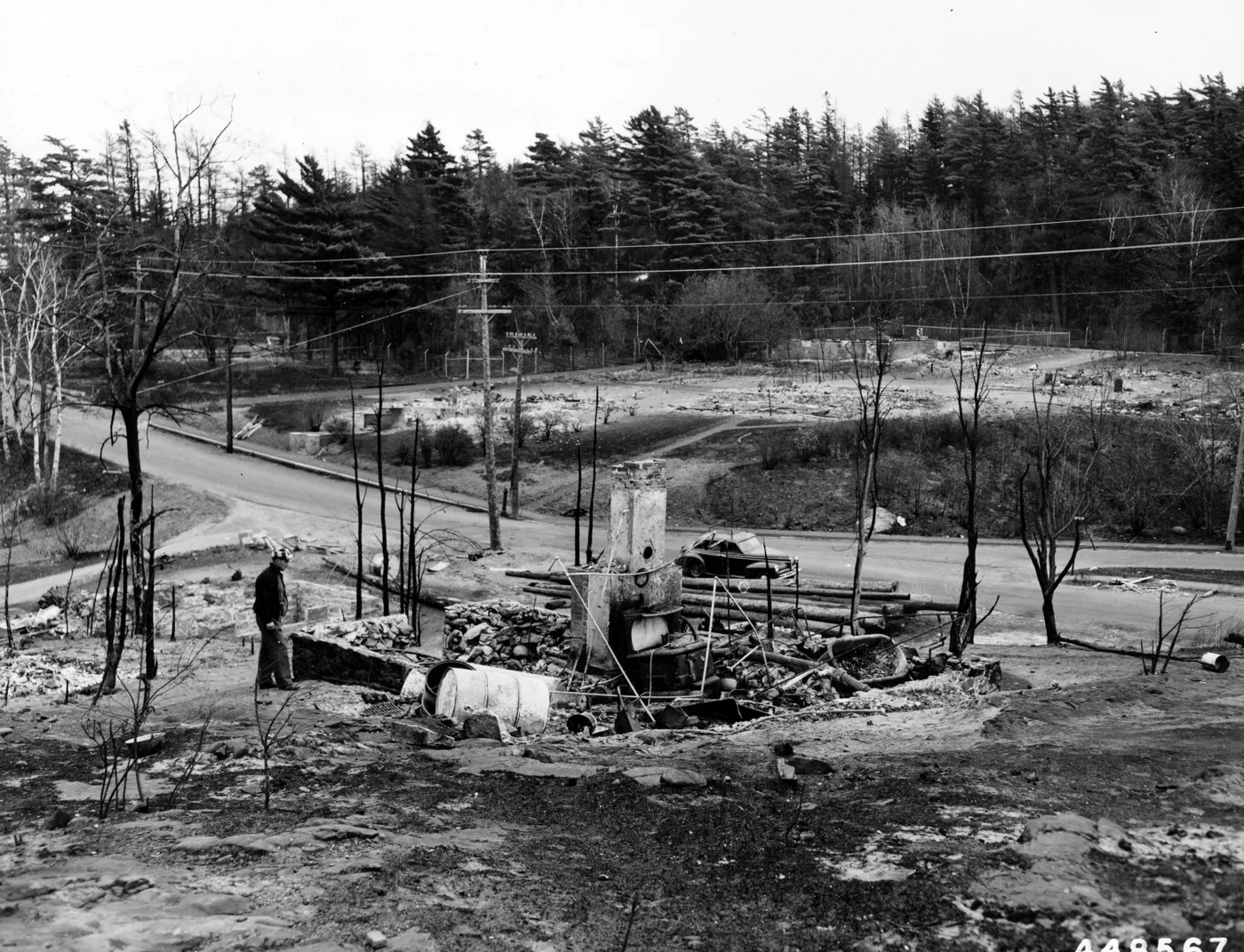
Mr. Paul Peterson examaining [sic] ruins of his aunt's home on Eagle Lake Road, Bar Harbor, Maine. Mr. Peterson's home, his aunt's, and his mother's were located within half a block of each other, all three were burned. The estate of Winfield Milleken is in background.Photo by Bluford Muir, U.S. Forest Service, 30 October 1947. National Archives, NAID 7104869 (Wikimedia Commons). U.S. government work, public domain.
4

What burned in the park

8,750 acres inside Acadia · NPS fire report, 27 February 1948

Inside Acadia National Park, the fire burned over 8,750 acres. Of that, 8,542 acres were forest, 184 grass and 24 brush. In the Park Service's 1948 report, The Mount Desert Island Fire of October 17 – November 14, 1947, Regional Forester Fred Arnold and Foresters Wilbur Savage and Robert Moore set out what had been lost.

Buildings

"In all, 15 park buildings and the Bear Brook Campground Amphitheater were razed to the ground." They ranged from two latrines at the Lake Wood beach, valued at $350 each, to the Homans House at $41,500. A footnote added later corrected the count: the Bear Brook Campground ranger quarters had not burned after all. The report asked Congress for $91,400 to rebuild everything except the Homans House.

The Homans House was almost certainly the old Homans cottage at Schooner Head. Eliza Homans and her husband, Dr. Charles Homans of Boston, summered from the 1870s at their cottage near the Schooner Head Overlook (NPS), on its south side (Acadia Memorials). In 1908 she gave the Bowl and the Beehive to the Hancock County Trustees of Public Reservations, the first large gift of land toward what became Acadia (NPS). After her death her heirs sold the estate in 1924 to George Dorr, and it passed to the United States in 1928. In 1931 the park renovated the house as a guest house for visiting Interior Department officials. The house and the landscape around it burned in 1947 (The History Trust). The house was not rebuilt. All that remains of the estate, which once had a house, farmhouse and stable, is a covered well and some pipes (The History Trust).

At Sieur de Monts Spring the fire destroyed the spring building and restroom the CCC had built. It damaged the spring canopy, cracked the stone and plaque of the memorial to George Dorr dedicated only months before, and burned footbridges and plantings. The Abbe Museum, built to be fireproof, survived. The park rebuilt the spring building and restroom on the same sites in the same rustic style by 1949 (Sieur de Monts Cultural Landscape Inventory).

Roads, paths and the small things

"Damage to park roads and trails as a result of the fire was extensive." The report asked for $22,000 to repair it, and another $82,000 for repairs after the heavy salvage and cleanup work it expected to come. "Numerous minor park structures and facilities were also destroyed or damaged. These included signs, markers, gates, guard rails, foot bridges and deer traps." The log guardrails along the motor roads went, and so did most of Beatrix Farrand's plantings along the carriage roads (Motor Road Cultural Landscape Inventory).

The forest

"Fire damage to Acadia's forests varies greatly on different areas from slight to total destruction." On about 3,455 acres, or 40 percent of the park forest that burned, the forest cover was "completely destroyed." On another 4,625 acres, 54 percent, the damage ran "from low to heavy." Only about 670 acres were "slightly affected." The foresters put the commercial value of the timber destroyed inside the park, "conservatively," at $337,125, and the park's total loss at $586,125, not counting the cost of fighting the fire. Counting the loss of recreational value, they added, would bring it "to a seven-digit total."

The conifers suffered most. Most spruce, fir and mixed stands in the burned part of the park "were either totally or largely destroyed and the organic and mineral soil was consumed or reduced and impoverished." Some were killed by crown fire racing through the treetops. Others were killed from below, by ground fire burning through the thick organic soil and the roots, followed by wind.

That second kind of damage struck some of the finest old forest in the park. In the old-growth spruce on Otter Point, the report says, the fire was "confined principally to their root systems, the above-ground portions showing surprisingly little evidence of fire."

"With the supporting soil burned away and the root systems reduced to short stubs most of the trees were soon thrown down by subsequent winds, the trees crashing like jack-straws in tangled masses as each falling tree or group knocked others down with it."NPS, The Mount Desert Island Fire, 1948, p. 46

Hardwoods fared better. In the Otter Creek valley, where the burn was light, "relatively little damage is obvious now, even in the understory." In the beech stands near Bliss Field, where the fire was "extremely intense," perhaps 40 percent of the trees were killed or soon would die. The foresters cautioned that the full toll among the hardwoods would not be known "until the trees leaf out next spring or a year from then."

The same fate met The Bubbles, as Favour's caption records. On the Park Service map, North Bubble and the Bubble Divide burned on 23 October, the day of the blow-up. The cliffs on the west side of South Bubble, above Jordan Pond, burned in the last days, 24 to 27 October.

Found in the field · The Bubbles, 2009 to 2016

  • The summit of North Bubble, 872 feet, 28 July 2009 Show on map
  • What we took for a Bates cairn on the North Bubble cliffs, 27 July 2012 Show on map
  • Iron bars, pins and steps set in the ledges Show on map Show on map
  • An iron bridge on the South Bubble cliffs, "almost totally lost," that "cannot be crossed," 23 October 2013 Show on map
  • An old road up the Bubble Divide that "ends in boulder field," probably used in clearing the fire damage, 27 July 2012 Show on map Show on map
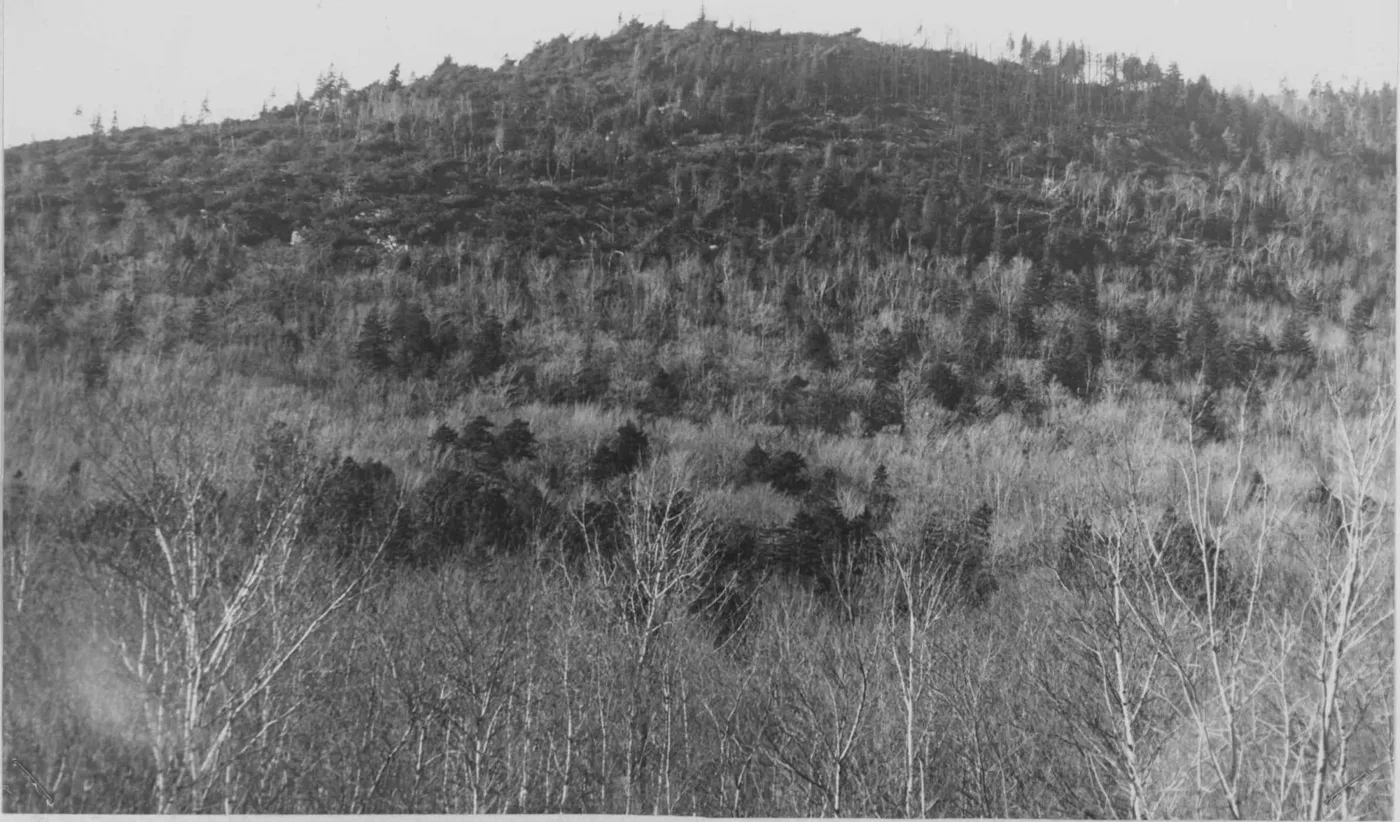
North Bubble in 1947, its summit and slopes covered with standing dead and fallen spruce, leafless hardwoods in the foreground
Formerly exhibiting one of the finest old-growth spruce forests in the park, the stands on top of The Bubbles were undermined by ground fire, then toppled over by wind — now a sad spectacle of tangled forest wreckage en masse. In this view of North Bubble the hardwood stands in the foreground are unburned.Photo by Paul G. Favour Jr., Acadia National Park, 1947. From NPS Region One, The Mount Desert Island Fire of October 17 – November 14, 1947 (1948).
5

Estates and paths that never came back

Cleftstone Road · Eden Street · Great Head · Schooner Head · The Bowl

Outside the park boundary, the 23 October blow-up swept through the estates of Bar Harbor. The atlas has already followed two of them. On Cleftstone Road, Anne Archbold's 1904 Italian villa and the Rowells' Barberry Ledge both burned. Today the land is part of Acadia National Park, and the Great Hill paths that climbed above them were never reopened (see From Golden Age to Lost Remains). On Eden Street, Fairview, built by Livingston and later the home of Mary Roberts Rinehart, was lost as well (see The Bar Harbor Water Company).

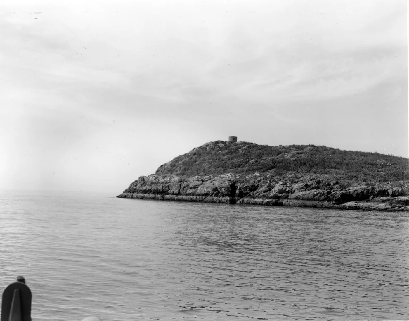
Great Head burned too. The fire razed the headland and left the Satterlee teahouse standing among the burned trees. In 1949 the two Satterlee daughters, Eleanor and Mabel, gave the estate, Sand Beach and Great Head to the National Park Service (NPS).

Most park trails in the burn were reopened by crews paid by the Village Improvement Associations and by John D. Rockefeller Jr. But "few people hiked them because of the ashes and soot," and "rapid growth of shrubs quickly obscured trails in the burned area, posing a continuing maintenance challenge" (NPS Hiking Trails Management Plan). The fire took sections of the 1901 Schooner Head Path, the old walk from the village to Schooner Head (National Register nomination). Some paths were moved.

That pattern shows up in our maps. About two-fifths of the lost and abandoned trail in the Atlas lies inside the 1947 burn. The fire was not the only reason these paths were given up: some went with the estates and some with changing park policy. But the burn line marks where many of them stopped being walked.

Found in the field · 2009

  • The South Summit of Great Hill, August 2009 Show on map
  • The junction of the Black and Green Trail with the Champlain South Ridge Trail "as rerouted after fire," 18 July 2009 Show on map
Great Head seen from the water, its slopes stripped of trees, with the small round stone teahouse on the summit
Fire razed Great Head in 1947 and the Satterlee Teahouse remained among the burned trees.NPS photo, Acadia National Park, after the fire (NPS). Credited to the Park Service without a copyright symbol, so public domain.
6

"Austere bareness": the cleanup

1947 to 1951 · 3,746 acres treated · 11.8 million board feet

The cleanup began almost at once. The 1948 report asked for $196,000 "for forest cleanup and fire hazard reduction along 22 miles of park roadsides, to a width of 200 feet on each side, and over an additional 3,800 acres within the park." The purposes were to make new fires less likely, to slow any that started, "and to improve or relieve the present fire-ravaged appearances." The foresters estimated that it would take at least 30,000 man-days of labor. The report also asked for $50,000 to replant 1,000 acres where "natural regeneration is likely to occur slowly" and where enough soil remained to hold seedlings.

The work was done under at least three contracts, paid for by the Park Service and by Rockefeller, along with park crews. Over 3,746 acres of "burned area treatment," they salvaged 11,811,593 board feet of sawlogs and 820 cords of pulpwood. Logs too short or defective for the contractors went to a small lath mill in Bar Harbor, which made slats for snow fences and lobster traps (Friends of Acadia, "Ghosts of '47").

The clearing could be too thorough. The Park Service's chief forester complained about the "austere bareness" of the cutover land. He urged "leaving, on the areas still to be worked, some trees, even though dead, to relieve the bareness of the landscape, and also leaving a sufficient amount of the forest debris on the ground to help prevent erosion, give protection to reproduction and help enrich the soil" (Friends of Acadia). Some of those logs are still on the ground (NPS).

Found in the field · the cleanup roads

  • Red & White Trail: "Fire clean-up road seems to turn downhill, away from trail, and ends here," 20 August 2014 Show on map
  • Red & White Trail: "On a path, perhaps a fire bulldozer road," 3 July 2009 Show on map
  • McFarland Mountain: "Fire break or road. Road ends," 3 August 2011 Show on map
  • The Bubble Divide: the road into the boulder field Show on map
A paved road after the fire lined with new utility poles, with cut and fallen fire-killed trees along both sides and dead pines beyond
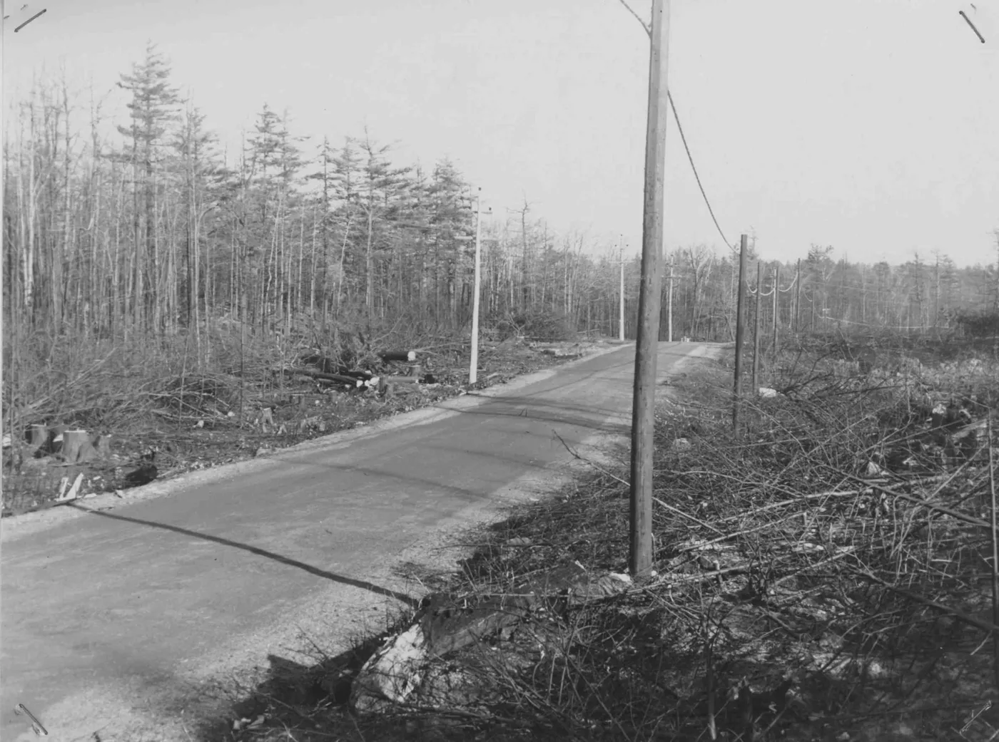
Immediately after burned utilities lines were replaced the companies cut clearance strips to prevent damage to new lines from windthrow of fire-killed trees.Photo by Paul G. Favour Jr., Acadia National Park, 1947. From NPS Region One, The Mount Desert Island Fire of October 17 – November 14, 1947 (1948).
7

The forest returns

Birch and aspen, then spruce · 1948 to today

Recovery began at once. Eleven months after the fire, Regional Forester Fred Arnold reported "an abundance of natural reproduction."

"Almost wherever there is soil, there are herbaceous plants, ferns, grasses, tree and shrub seedlings or sprout growth. In some places, beds of gray birch seedlings were observed growing in such density as to obscure the ground completely. Aspen seedlings are also abundant and specimens five feet tall are not rare."Fred Arnold, September 1948, quoted by Friends of Acadia

Even in severely burned areas he found spruce, balsam fir, white pine and hemlock seedlings wherever soil remained. Replanting plans were drawn up in 1950, and the foresters insisted on native stock (Friends of Acadia).

Mostly, though, nature did the work. Wind carried seeds back into the burn, and some hardwoods grew back from stumps and roots. The forest that grew was not the one that had burned. Spruce and fir gave way to sun-loving birch and aspen (NPS), joined by beech, oak and maple (NPCA).

Scorched spruce that still held its cones seeded new spruce beneath the hardwoods (Fire Science North Atlantic). William Patterson of the University of Massachusetts surveyed the burn in 1980 and again in 1992–94. Jessica Charpentier returned to 23 stands in 2016, sixty-eight years after the fire. She found widespread red spruce coming up after the first aspen and birch, which she took as evidence that Acadia's forests are resilient to wildfire. The stands that had not burned were still mature-to-overmature spruce and fir (Charpentier, Antioch University).

The new forest changed the animals, too. The aspen and birch fed a growing beaver population, which peaked around 1980 (NPS). Deer, partial to young hardwoods, boomed (NPS). Hardwood leaf litter made a forest floor where ticks and their small-mammal hosts thrive (NPS).

Below ground, the burn is still measurable. Scientists comparing the burned Cadillac Brook watershed with unburned Hadlock Brook found thinner soils with less organic matter. Today Cadillac Brook is about 20 percent young mixed hardwoods and 60 percent shrub and bare rock (Kahl and others, 2007).

Found in the field · 13 July 2009

  • False G&B Trail: an "Old Pine Tree, probably pre-fire" Show on map
8

The face of Acadia today

Fall color, ghost stumps and the return of spruce

The clearest mark the fire left is the one visitors come for each October. Instead of one uniform evergreen forest, eastern Mount Desert now turns red, yellow and orange, a mix of color supplied by the deciduous forests that grew after 1947. "As you drive the park loop road," the Park Service suggests, "notice the change in vegetation types that is especially visible on the sides of the mountains" (NPS).

That will not last forever. The birch and aspen are short-lived. As they shade the forest floor, they make a nursery for the shade-loving spruce and fir that may eventually take the ground back (NPS). The burned forests are following that path, as paper birch and bigtooth aspen die back and red spruce and red maple replace them (NPS).

"They are fairly quickly going from aspen and birch to spruce and fir – more quickly than I would have expected. With that, the forests will be greener year-round and we won't have some of the dramatic fall colors."William Patterson, 2017, in the Portland Press Herald

Charpentier found that fuel loads are generally low to moderate inside the 1947 boundary and high to very high outside it. As spruce and fir return, the fire risk inside the old burn may rise again (Charpentier).

In the woods the fire is still there if you know where to look: a cleanup road that ends in a boulder field, a firebreak crossing an old path, a pine that was already old in 1947, and the stumps of fire-killed trees that have weathered into strange shapes (Friends of Acadia).

Timeline

The fire and after

  1. 1933–1942CCC crews clear slash and windthrow and cut firebreaks in the park.
  2. Summer–fall 1947Several months without rain.
  3. 17 Oct 1947, 4:05 p.m.Fire reported at Dolliver's Dump, Fresh Meadow.
  4. 18–20 OctHeld to about 100 acres, then patrolled; 169 acres in three days.
  5. 21 OctStrong winds; the fire breaks out, over 2,000 acres.
  6. 22 OctNearly 2,300 acres more.
  7. 23 OctThe blow-up: six miles in under three hours. Hulls Cove and Bar Harbor are evacuated, and the fire reaches the sea.
  8. 24 OctPaul Favour maps the fire edge from the air.
  9. 27 OctFire declared under control.
  10. 14 Nov, 4 p.m.Fire declared out.
  11. 27 Feb 1948Arnold, Savage and Moore complete the Park Service fire report.
  12. Sept 1948Arnold reports abundant natural regrowth.
  13. 1949Sieur de Monts spring building and restroom rebuilt.
  14. 1950Replanting plans drawn up, using native stock.
  15. 28 Jan 1951Superintendent Hadley's cumulative report on the timber salvage.
  16. 1980, 1992–94William Patterson surveys the burn.
  17. 1990The Park Service digitizes the burn by day.
  18. 2016Jessica Charpentier resurveys 23 stands.
Sources

Reports, studies and records

The main sources behind this story. Page references to the 1948 report are to its own page numbers.

Photo credits and rights

PhotographPhotographer and sourceRights
North Bubble, 1947 (opening and section 4)Paul G. Favour Jr., Acadia National Park ranger. NPS Region One, The Mount Desert Island Fire (1948), p. 66Public domain: made by a federal employee as part of his duties
Utility-line clearance strip, 1947 (section 6)Paul G. Favour Jr. Same report, p. 72Public domain, as above
Ruins at Bar Harbor, 28 October 1947 (section 3)Bluford Muir, U.S. Forest Service. National Archives, NAID 7104876, via Wikimedia CommonsPublic domain: U.S. government work (National Archives)
Eagle Lake Road, 30 October 1947 (section 3)Bluford Muir, U.S. Forest Service. National Archives, NAID 7104869, via Wikimedia CommonsPublic domain, as above
Great Head and the Satterlee teahouse (section 5)National Park Service, The Fire of 1947Public domain: credited "NPS Photo" with no copyright symbol (NPS)

Photographs have been lightly cropped and their contrast adjusted. This page was researched and drafted with AI assistance from the Park Service report, the fire department's account, the GIS burn map and our field records, and reviewed by the Lost Trails crew.

Walk lightly

Lost and abandoned trails are not mapped, marked or maintained by the park, and some of the old routes in the burn cross steep ledges and broken ironwork. Treat these lines as history, not an invitation. Leave stumps, ironwork and every other find where it lies; removing artifacts from park land is against federal law.