Below Oak Hill in Tremont, the old Seal Cove Road ran past a string of small farms. The Norwoods came first, in the 1820s, and the Kelleys followed. For a hundred years they cleared fields, built walls, dug wells and buried their dead on a knoll above the road. By 1937 the land belonged to the United States. The woods have grown back over it, but the cellar holes, the wells and one gravestone are still there.
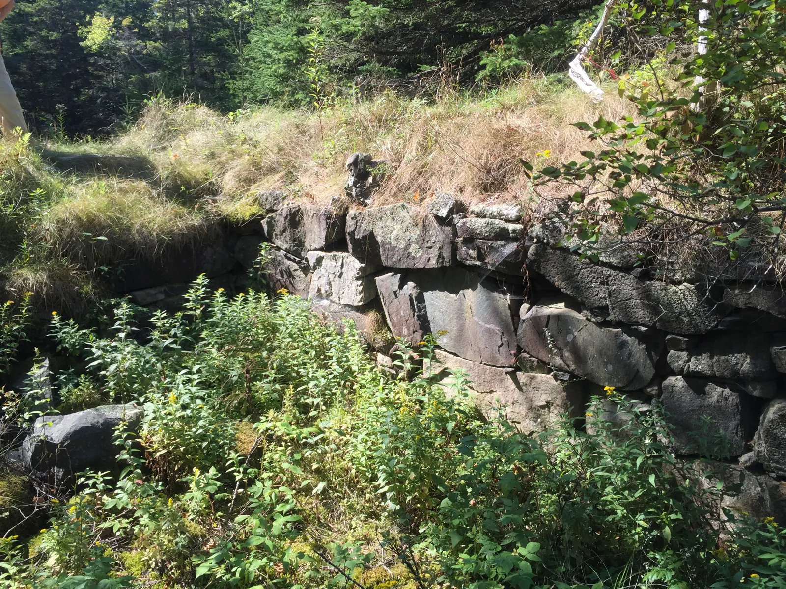
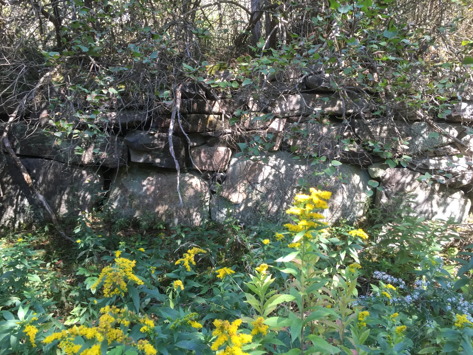
Cellar stonework at the Jonathan Norwood homestead, 16 Sep 2015
1828Benjamin Norwood buys Lot 87 from the Boylston estate, the first deed in the chain
8 placesNorwood and Kelley homesteads, a family cemetery and a lone grave, recorded by the crew
1937Fred Walls sells Lots 87 and 88 to the United States on 18 January
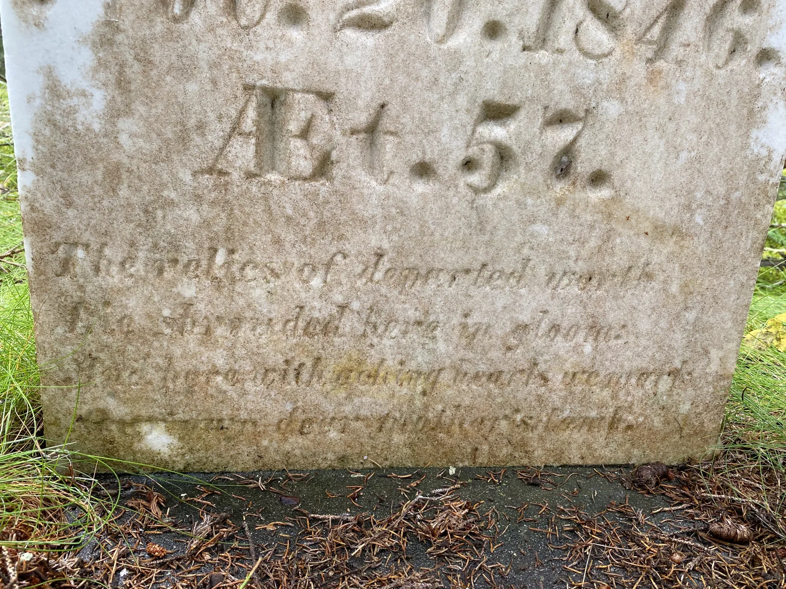
1846Mary Norwood dies at 57; her headstone still stands on the knoll above the road
A road between two harbors
The old Seal Cove Road
Before the state roads, this was the main way between Southwest Harbor and Manset on one side and Seal Cove and Bass Harbor on the other. A Bar Harbor Times writer who walked it in 1960 said the old roads here were "laid out well before 1850 and have fallen into disuse in the 1930's" (Bar Harbor Times, 4 Aug 1960). Along the way he found the farms by their cellar holes, "marked by the inevitable lilac bushes, which seem to thrive in desolation, and the apple trees, which don't" (Bar Harbor Times).
The farms sat on two of the island's numbered lots, 87 and 88, running back from the road toward Oak Hill. The 1880s atlases mapped the road and its houses (1881 Colby Atlas of Hancock County). The crew used the 1887 Colby and Stuart map, which names households such as T. O. Norwood, G. M. Kelly and N. B. Kelley, to match each name to a hole in the ground.
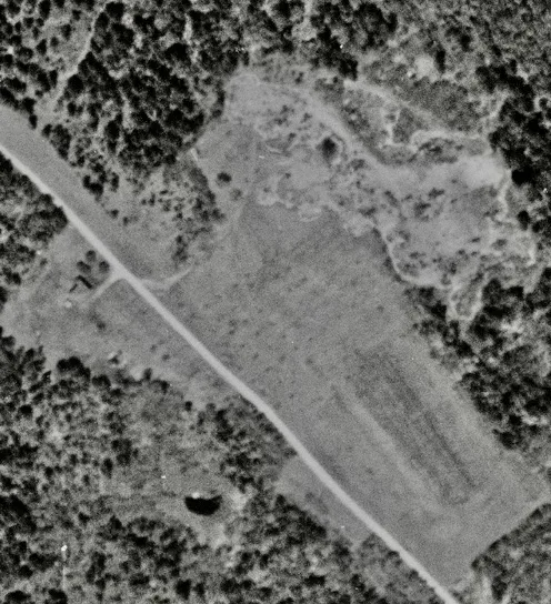
Seal Cove Road and the old Norwood fields in 1944, seven years after the sale to the park. The fields were still open. Aerial photograph from the Lost Trails files.
Then and now
The homesteads on the map
Each lettered pin is a homestead or burial place. The small dots are what the crew recorded around it in 2015 and 2022: cellar holes, wells, walls, dumps and old roads. Switch the base to LiDAR to see the ground under the trees. Click any point for its field note.
House site, cellar or foundationWell or springWall, grave or other featureRoad, path or dump
House by house
Eight places along the road
From west to east, roughly in the order you would pass them walking from Seal Cove. The house names come from the 1880s maps and the deeds; the crew's field names are kept in the map notes.
TT. O. Norwood place
On the 1887 map · crew visits Aug 2015 and Sep 2022
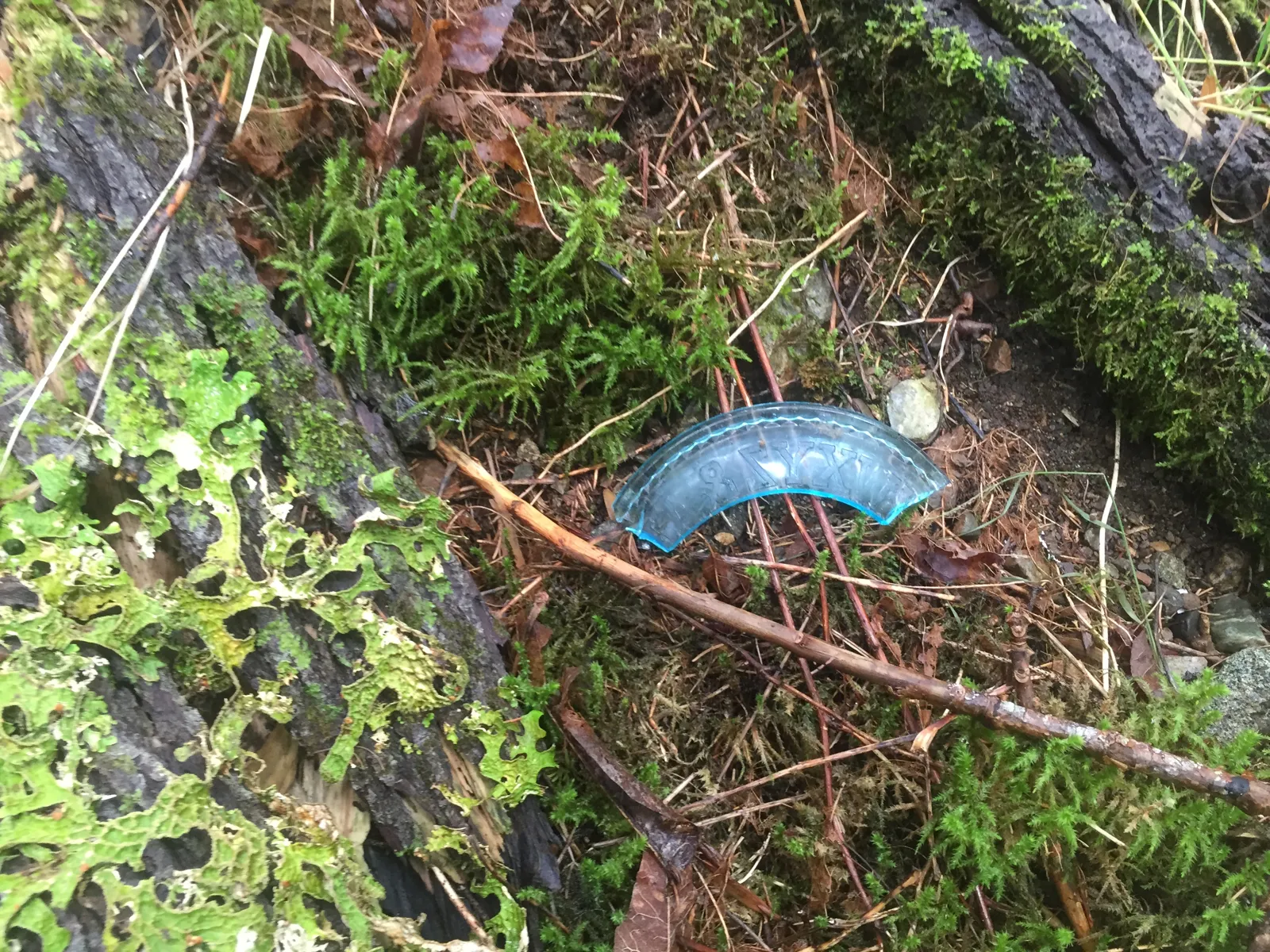
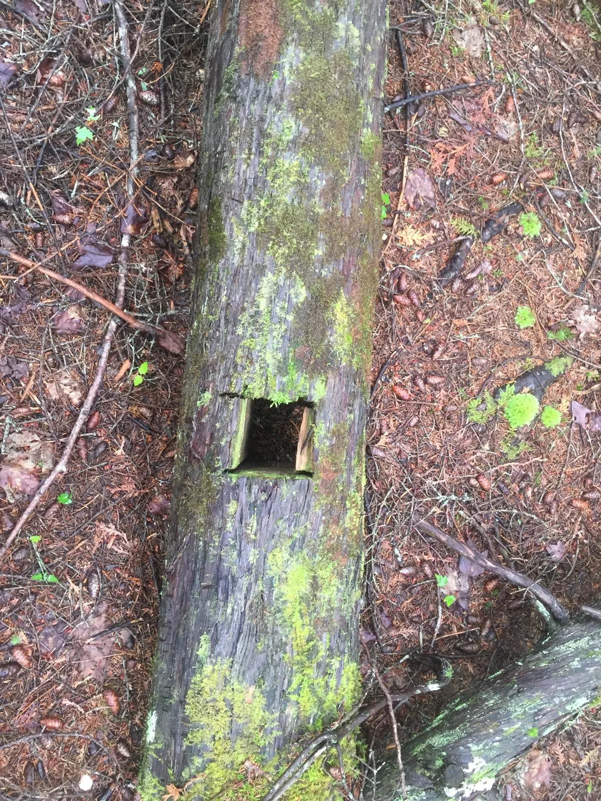
The westernmost house, right at the edge of today's park. The crew found a cellar hole about 15 feet square and a cluster of shallow dug wells or springs, one lined with rock. A blue glass fragment and a mortised sill log lay nearby.
Dower lot, 1857 · Willard Norwood from 1881 · crew visits 2015 and 2022
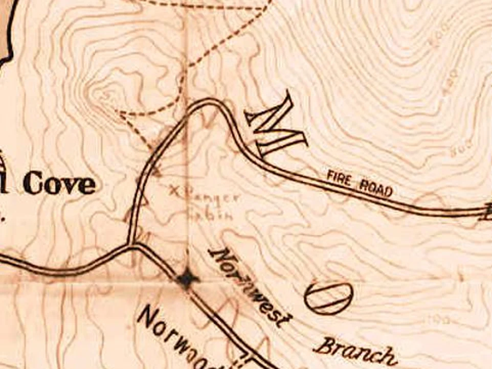
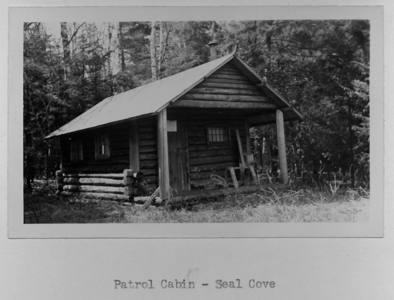
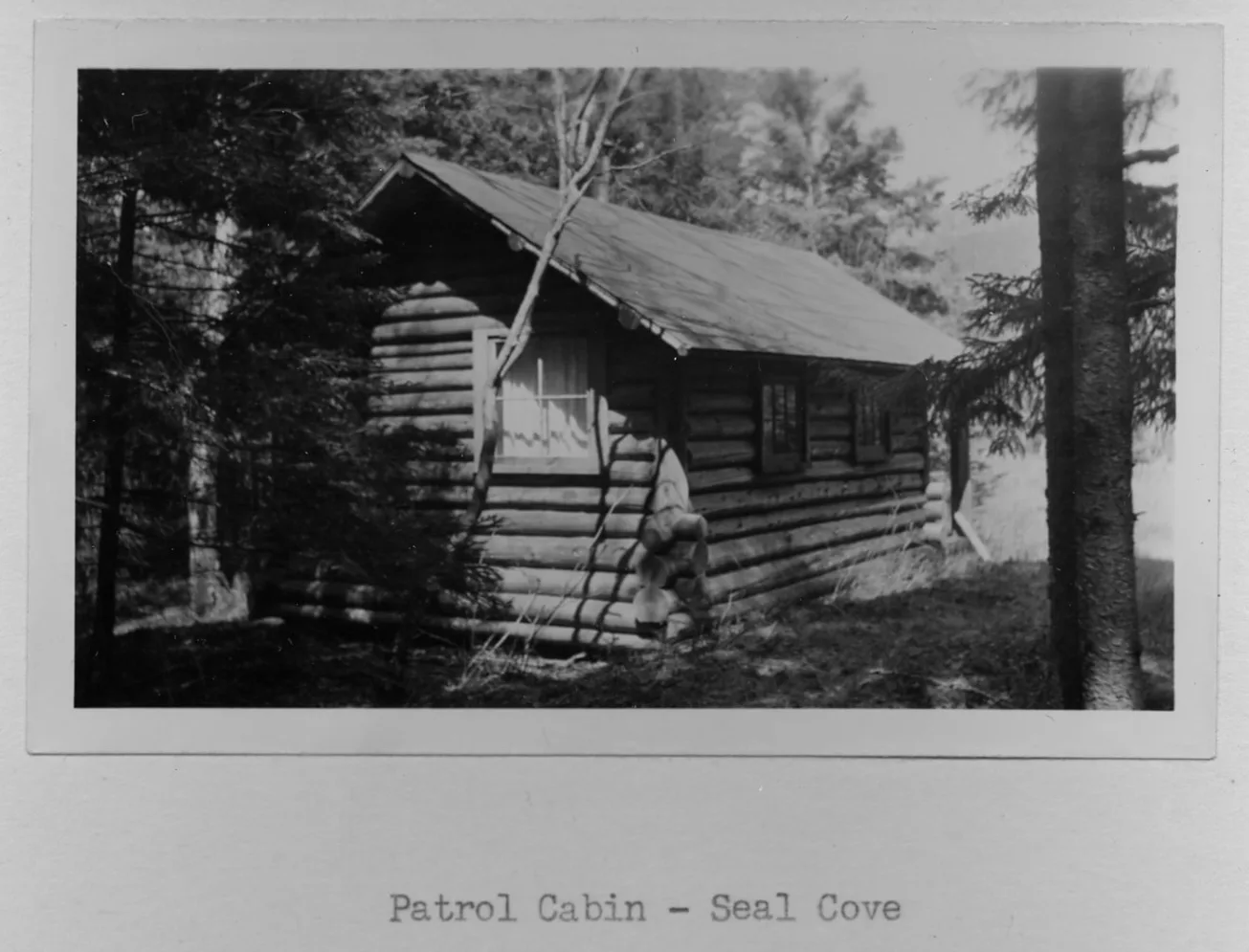
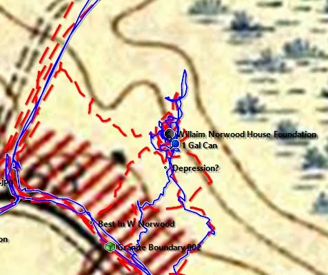
A house aligned about 95 degrees, with a fallen-in foundation about 12 by 30 feet, a square 10 by 12 foundation, a pile of chimney brick and stone walls on two sides. The crew's 2015 notes call it the William Norwood place; the deeds say Willard. The 1937 park master plan marks a ranger camp here and the 1941 plan a ranger station, and the crew found a piece of barrel and stovepipe beside the old cellar. This is the probable site of the park's Seal Cove patrol cabin, shown in the map detail and photographs below.
WThe Seal Cove patrol cabin · probable location of the ranger hut after the property transferred to the park in 1937
Map detail marking "× Ranger Cabin" just north of Seal Cove Road, by the Norwood farms and the Northwest Branch. Old park map, from the crew's 2022 search files."Patrol Cabin – Seal Cove," front and porch. Print no. 2343, National Archives; copy courtesy of Terese Miller."Patrol Cabin – Seal Cove," side view. Print no. 2380 (Box 48, Item 2799), National Archives; copy courtesy of Terese Miller.
The prints are not dated or located beyond "Seal Cove." The crew places the cabin at the Willard Norwood place because an old park map marks "Ranger Cabin" just north of the road here, the 1937 west-side master plan marks a ranger camp, reached by a lane from Seal Cove Road; LaRue Spiker's 1960 Bar Harbor Times article mentions a park ranger cabin on the road; and a piece of barrel and stovepipe still lies on the ground near the old cellar. The cabin was log built and probably stood beside the foundation rather than on it. When it was taken down is not yet known.
JJonathan (John) Norwood homestead
Lot 88 · Norwood family from the 1830s · crew visits 2015 and 2022
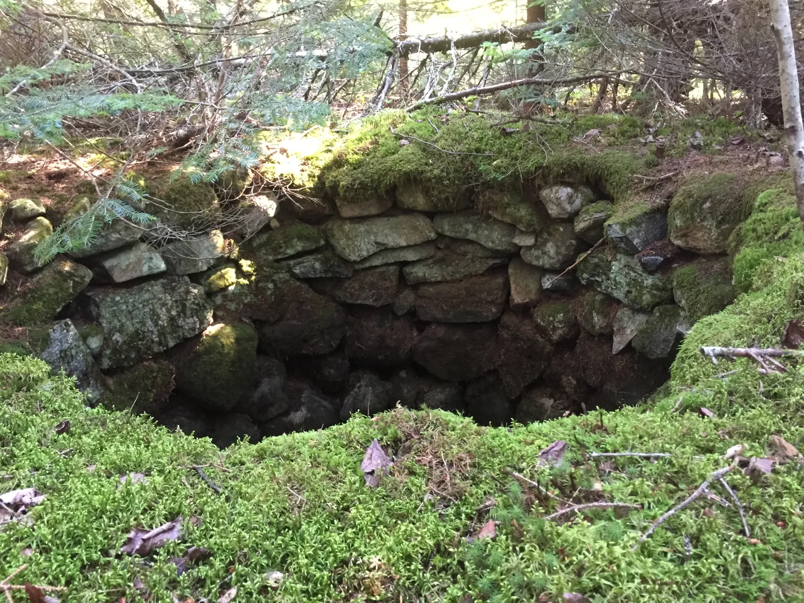
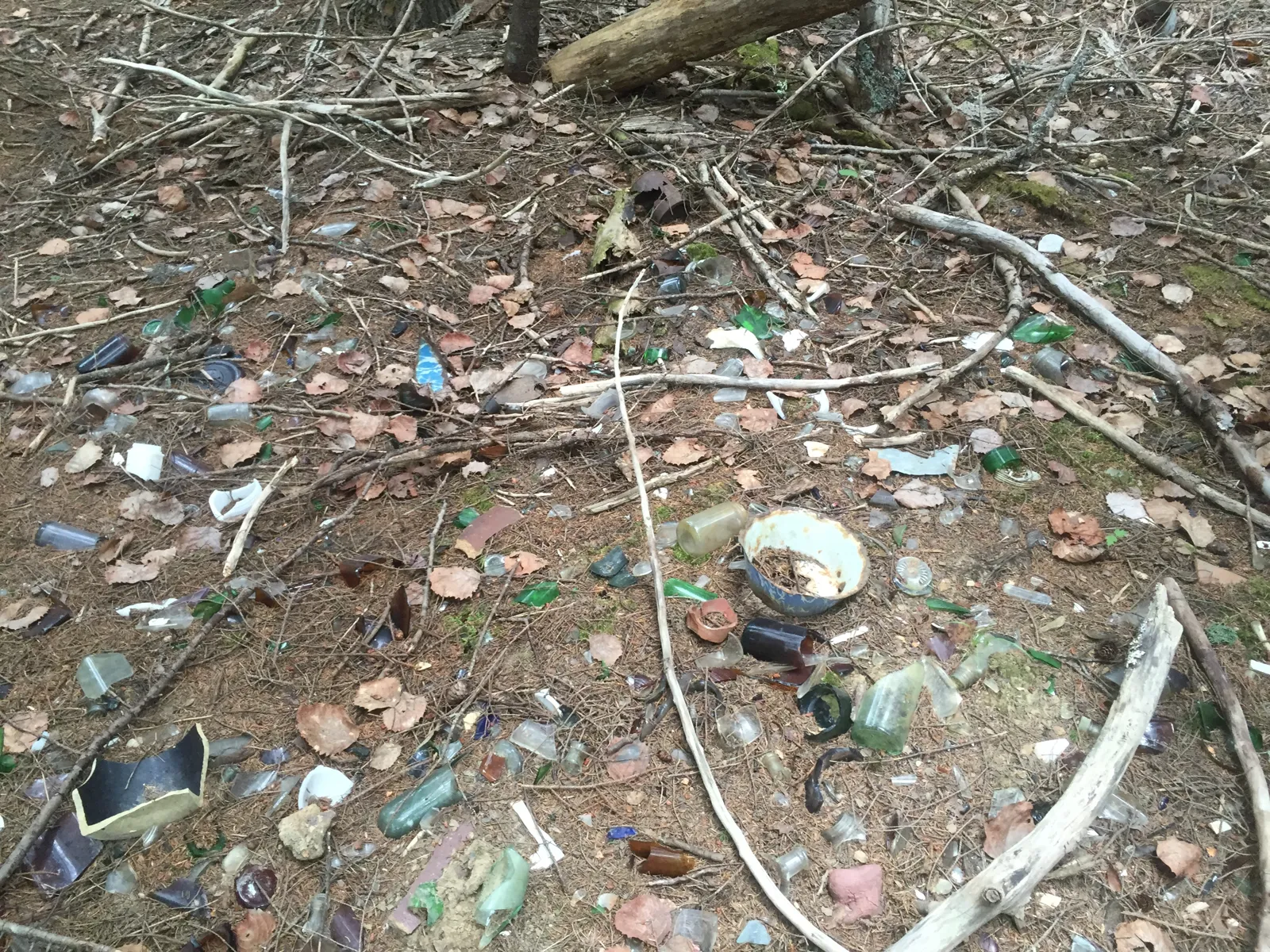
The best preserved of the farms. The cellar walls of squared stone still stand chest high in places. There is a well with a pipe leading northeast, a round stone-lined hole 20 feet across, a pit by the northeast corner of the house still half covered with old boards, and a large dump behind it with bottles, jugs and pieces of automobiles.
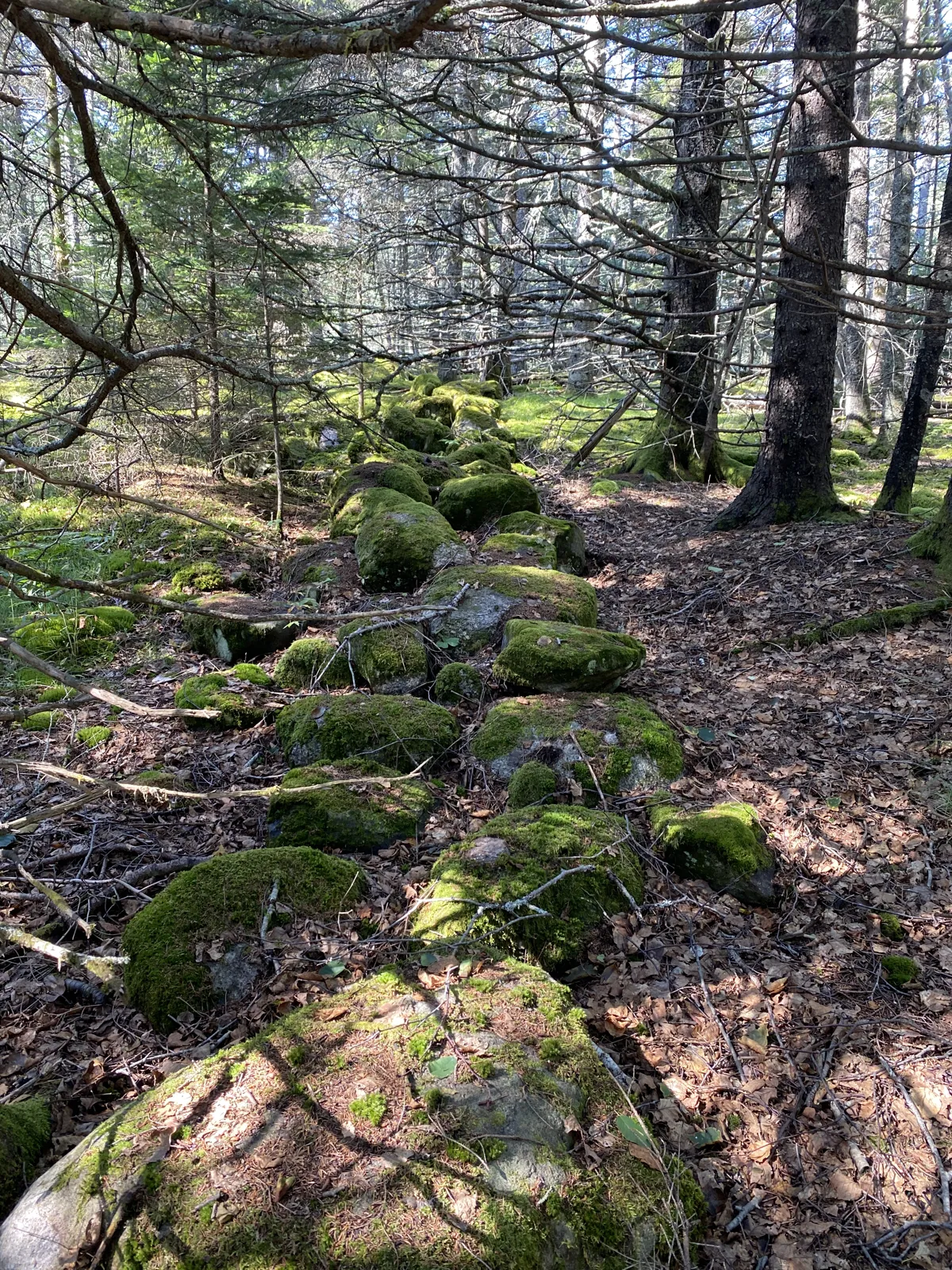
On a knoll north of the road, a single white headstone stands among stone walls that once edged the Norwood fields. Nearby the crew found rows of evenly spaced pines, likely planted on the old fields.
North side of Seal Cove Road · crew visits 2015 and 2016
The Kelley family burial ground lies on the north side of Seal Cove Road about 0.8 mile from Route 102 (VF Thomas, Tremont cemeteries). From here an old road ran south to Kelleytown. The crew also found the corner between Lots 86 and 87.
George M. Kelley, Lot 87, from 1860 · crew visits Aug 2015
A foundation just off Seal Cove Road with its dump a little to the east. George M. Kelley took Lot 87 in 1860, and it stayed in the Kelley family until it was lost to mortgages and foreclosure around 1919.
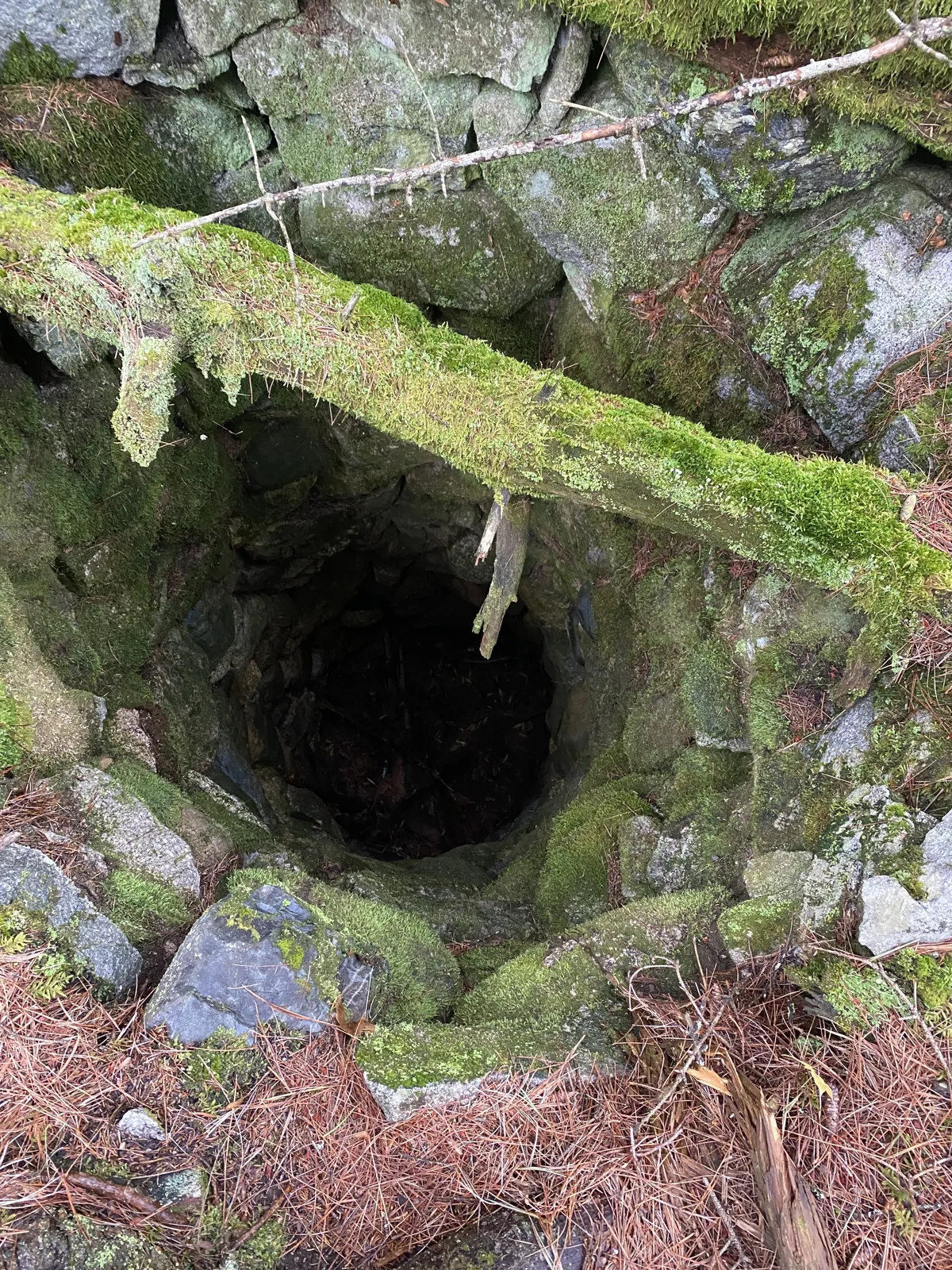
A depression that is probably the cellar hole, a stone wall running off at 150 degrees, a T where two roads met, and a very deep well lined with stone that still holds its shape.
A cellar hole, a possible filled-in well, a long rock pile and a wide spread of old bottles and cans. This is the Samuel Norwood house, recorded by the crew as "S Norwood Est.", where a lilac led Kim Sebold to the cellar hole in 1998.
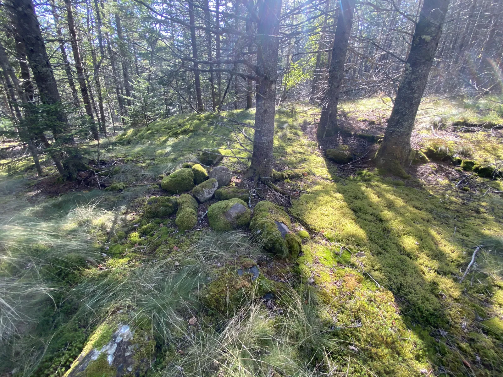
Cellar wall at the Jonathan Norwood homestead, 16 Sep 2015Stone-lined hole by the Jonathan Norwood well, 16 Sep 2015The deep stone-lined well at the N. B. Kelley place, 21 Aug 2022Blue glass at the T. O. Norwood cellar hole, 12 Aug 2015A mortised sill log near the T. O. Norwood place, 12 Aug 2015The dump at the Samuel Norwood place, 11 Aug 2015
A stone on the knoll
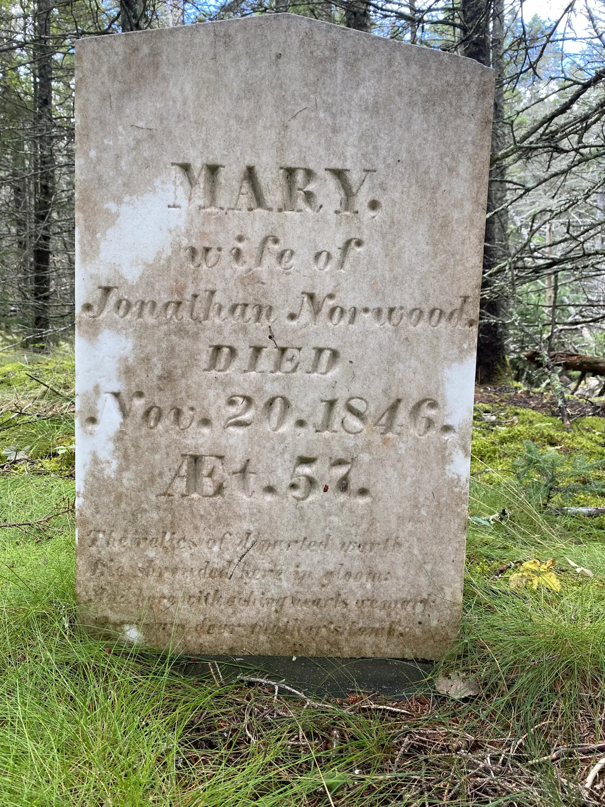
Mary, wife of Jonathan Norwood
The headstone reads "MARY, wife of Jonathan Norwood, DIED Nov. 20, 1846, Æt. 57." The day is worn; it may be the 29th. That puts her birth around 1789. Under the dates is a verse:
The relics of departed worth Lie shrouded here in gloom And here with aching hearts we mark Our own dear mother's tomb
The Tremont cemetery survey places Norwood graves on a knoll north of Seal Cove Road about 0.7 to 0.8 mile from Route 102 (VF Thomas). That is a different place from the Norwood Cemetery on Richtown Road. The deeds suggest Jonathan married again: when his estate was settled in 1857, a 30-acre dower lot was set off for his widow, Margaret.
Mary Norwood's headstone, 19 Aug 2022
The age and the verse, 19 Aug 2022Field wall north of the homestead, 20 Aug 2022The long wall leading north, 20 Aug 2022
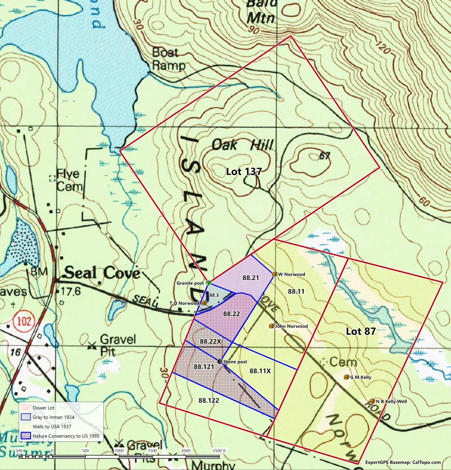
Lot 87 passed from Benjamin Norwood to Joseph M. Kelley in 1847 and to George M. Kelley in 1860, then down the Kelley family. Mortgages in 1911 and 1914, and a town tax lien in 1917, ended in foreclosure, and the lot went to Fred Walls in 1919 and 1920.
Lot 88 was Norwood land. Jonathan Norwood deeded part of it to Oliver and Samuel Norwood in 1839. After mortgages and defaults in the 1840s, Jonathan's estate was sold at auction in 1856. In 1893 a deed still called 40 acres of it the "Homestead lot on which they now live." Willard Norwood bought the 35-acre dower lot in 1881, and it passed to Amanda Norwood and then by will in 1921. The main part of Lot 88 changed hands several times after 1903 before Fred Walls bought it in 1918.
On 18 January 1937 Fred Walls sold both lots to the United States (Hancock County deeds 655/274). The southern parts of Lot 88 joined the park much later, in 1993 and 1995, through the Nature Conservancy.
The crew's map of Lots 87 and 88 below Oak Hill (Lot 137), showing the dower lot, the 1937 sale and the 1995 addition. Click to enlarge.
After the farms
Ranger station, then woods
The park did not leave the place empty at first. The 1937 master plan marks a ranger camp at the Willard Norwood place and the 1941 plan a ranger station, and the crew found a patrol cabin site, a possible ranger camp and the path to them. Two archival prints labeled "Patrol Cabin – Seal Cove" show the log cabin that probably stood there (see the photographs). The 1944 aerial photograph shows the fields still open and a small building in a clearing to the north. The same years brought the CCC picnic ground on Oak Hill just above (Pine Hill and Oak Hill; NPS Multiple Property Documentation).
After that the road went quiet and the forest returned. When the Bar Harbor Times writer came through in 1960, the farms were already lilacs and cellar holes. Another Times piece, LaRue Spiker's "Seal Cove Once Knew Life Of Economic Activities, Faint Memories Remain," recalls the busier days (Spiker, Bar Harbor Times).
The crew's tracks and points over a detail of the 1941 master plan at the Willard Norwood foundation.
Timeline
A hundred years on Seal Cove Road
4 Sep 1828Benjamin Norwood buys Lot 87 from the Boylston estate (Hancock deeds 72/405).
1839Jonathan Norwood deeds part of Lot 88 to Oliver and Samuel Norwood.
Nov 1846Mary, wife of Jonathan Norwood, dies at 57 and is buried on the knoll north of the road.
1847Lot 87 passes to Joseph M. Kelley.
1856–57Jonathan Norwood's estate is sold at auction, and a 30-acre dower lot is set off for his widow, Margaret.
1860George M. Kelley takes Lot 87.
1881Willard Norwood buys the 35-acre dower lot. The Colby atlas of Hancock County maps the road and its houses.
1887The Colby and Stuart map names T. O. Norwood, G. M. Kelly and the other households.
1917–20A town tax lien and foreclosure; Fred Walls acquires Lot 87, having bought most of Lot 88 in 1918.
1930sThe old road falls out of use.
18 Jan 1937Fred Walls sells Lots 87 and 88 to the United States.
1937The west-side master plan marks a ranger camp at the Willard Norwood place, probably the Seal Cove patrol cabin.
1941The park master plan shows a ranger station at the Willard Norwood site.
1944An aerial photograph shows the old fields still open.
1993–95The southern parts of Lot 88 join the park through the Nature Conservancy.
1998Kim Sebold follows a lilac to Samuel Norwood's cellar hole.
2015 and 2022The Lost Trails crew records the homesteads, wells, walls and Mary Norwood's stone.
Walk lightly
These sites are on park land north and south of Seal Cove Road, which is a public road with private homes along it. The T. O. Norwood site lies right at the park's west edge, so stay on the park side of the boundary posts there, and don't use private driveways for access. Cellar holes and wells can be deep and hidden by brush. Look and take photographs, but leave every stone, bottle and fragment where it lies, and treat the graves with care.
Kim Sebold. "Lilacs, Cellar Holes, and the Courthouse: A Historian's Reflections on Re-Creating Mount Desert Islanders." Maine History 42:1 (July 2004). academia.edu
VF Thomas. Tremont cemeteries, MDI Cultural History Project. vfthomas.com
U.S. National Park Service. Historic Resources of Acadia National Park, Multiple Property Documentation Form, with the 1941 master plan. npshistory.com
Field photographs by Les Heilakka, August 2015 and August 2022. The 1944 aerial photograph and the 1941 plan detail are copies in the Lost Trails files. Lot map, field notes and GPS points by the Lost Trails crew, 2015–2022. Modern owners are not named.